Category:1911 Sanborn Fire Insurance Map from Grinnell, Poweshiek County, Iowa
Jump to navigation
Jump to search
Media in category "1911 Sanborn Fire Insurance Map from Grinnell, Poweshiek County, Iowa"
The following 42 files are in this category, out of 42 total.
-
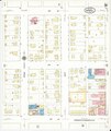
 Sanborn Fire Insurance Map from Grinnell, Poweshiek County, Iowa. LOC sanborn02673 006-1.jpg 6,450 × 7,650; 4.07 MB
-
 Sanborn Fire Insurance Map from Grinnell, Poweshiek County, Iowa. LOC sanborn02673 006-1.tiff 6,450 × 7,650; 141.17 MB
-

-
 Sanborn Fire Insurance Map from Grinnell, Poweshiek County, Iowa. LOC sanborn02673 006-10.tiff 6,450 × 7,650; 141.17 MB
-
-
 Sanborn Fire Insurance Map from Grinnell, Poweshiek County, Iowa. LOC sanborn02673 006-11.tiff 6,450 × 7,650; 141.17 MB
-

-
 Sanborn Fire Insurance Map from Grinnell, Poweshiek County, Iowa. LOC sanborn02673 006-12.tiff 6,450 × 7,650; 141.17 MB
-
-
 Sanborn Fire Insurance Map from Grinnell, Poweshiek County, Iowa. LOC sanborn02673 006-13.tiff 6,450 × 7,650; 141.17 MB
-

-
 Sanborn Fire Insurance Map from Grinnell, Poweshiek County, Iowa. LOC sanborn02673 006-14.tiff 6,450 × 7,650; 141.17 MB
-

-
 Sanborn Fire Insurance Map from Grinnell, Poweshiek County, Iowa. LOC sanborn02673 006-15.tiff 6,450 × 7,650; 141.17 MB
-

-
 Sanborn Fire Insurance Map from Grinnell, Poweshiek County, Iowa. LOC sanborn02673 006-16.tiff 6,450 × 7,650; 141.17 MB
-

-
 Sanborn Fire Insurance Map from Grinnell, Poweshiek County, Iowa. LOC sanborn02673 006-17.tiff 6,450 × 7,650; 141.17 MB
-
-
 Sanborn Fire Insurance Map from Grinnell, Poweshiek County, Iowa. LOC sanborn02673 006-18.tiff 6,450 × 7,650; 141.17 MB
-

-
 Sanborn Fire Insurance Map from Grinnell, Poweshiek County, Iowa. LOC sanborn02673 006-19.tiff 6,450 × 7,650; 141.17 MB
-
 Sanborn Fire Insurance Map from Grinnell, Poweshiek County, Iowa. LOC sanborn02673 006-2.jpg 6,450 × 7,650; 2.65 MB
-
 Sanborn Fire Insurance Map from Grinnell, Poweshiek County, Iowa. LOC sanborn02673 006-2.tiff 6,450 × 7,650; 141.17 MB
-

-
 Sanborn Fire Insurance Map from Grinnell, Poweshiek County, Iowa. LOC sanborn02673 006-20.tiff 6,450 × 7,650; 141.17 MB
-

-
 Sanborn Fire Insurance Map from Grinnell, Poweshiek County, Iowa. LOC sanborn02673 006-21.tiff 6,450 × 7,650; 141.17 MB
-

-
 Sanborn Fire Insurance Map from Grinnell, Poweshiek County, Iowa. LOC sanborn02673 006-3.tiff 6,450 × 7,650; 141.17 MB
-
 Sanborn Fire Insurance Map from Grinnell, Poweshiek County, Iowa. LOC sanborn02673 006-4.jpg 6,450 × 7,650; 2.53 MB
-
 Sanborn Fire Insurance Map from Grinnell, Poweshiek County, Iowa. LOC sanborn02673 006-4.tiff 6,450 × 7,650; 141.17 MB
-
 Sanborn Fire Insurance Map from Grinnell, Poweshiek County, Iowa. LOC sanborn02673 006-5.jpg 6,450 × 7,650; 2.48 MB
-
 Sanborn Fire Insurance Map from Grinnell, Poweshiek County, Iowa. LOC sanborn02673 006-5.tiff 6,450 × 7,650; 141.17 MB
-
 Sanborn Fire Insurance Map from Grinnell, Poweshiek County, Iowa. LOC sanborn02673 006-6.jpg 6,450 × 7,650; 2.24 MB
-
 Sanborn Fire Insurance Map from Grinnell, Poweshiek County, Iowa. LOC sanborn02673 006-6.tiff 6,450 × 7,650; 141.17 MB
-
 Sanborn Fire Insurance Map from Grinnell, Poweshiek County, Iowa. LOC sanborn02673 006-7.jpg 6,450 × 7,650; 2.17 MB
-
 Sanborn Fire Insurance Map from Grinnell, Poweshiek County, Iowa. LOC sanborn02673 006-7.tiff 6,450 × 7,650; 141.17 MB
-
 Sanborn Fire Insurance Map from Grinnell, Poweshiek County, Iowa. LOC sanborn02673 006-8.jpg 6,450 × 7,650; 2.61 MB
-
 Sanborn Fire Insurance Map from Grinnell, Poweshiek County, Iowa. LOC sanborn02673 006-8.tiff 6,450 × 7,650; 141.17 MB
-
 Sanborn Fire Insurance Map from Grinnell, Poweshiek County, Iowa. LOC sanborn02673 006-9.jpg 6,450 × 7,650; 3.09 MB
-
 Sanborn Fire Insurance Map from Grinnell, Poweshiek County, Iowa. LOC sanborn02673 006-9.tiff 6,450 × 7,650; 141.17 MB


