Category:1914 maps of Texas
Jump to navigation
Jump to search
States of the United States: California · Hawaii · Idaho · Illinois · Iowa · Kentucky · Louisiana · Massachusetts · Michigan · Minnesota · Missouri · Montana · Nevada · New York · North Dakota · Oklahoma · Pennsylvania · South Dakota · Texas · Vermont · Washington · West Virginia · Wisconsin · Wyoming – Washington, D.C.
| ← 1910 1911 1912 1914 1915 1917 1918 1919 → |
Media in category "1914 maps of Texas"
The following 2 files are in this category, out of 2 total.
-
-
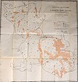
 San Jacinto Co. LOC 2008621662.jpg 10,606 × 13,293; 19.16 MB
_(19175392998).jpg)
