Category:1917 maps of Africa
Jump to navigation
Jump to search
Temperate regions: North America · South America · Africa · Europe · Asia · – Polar regions: – Other regions:
| ← 1910 1911 1912 1913 1914 1915 1916 1917 1918 1919 → |
Media in category "1917 maps of Africa"
The following 6 files are in this category, out of 6 total.
-
 Africa1910s.jpg 940 × 1,128; 456 KB
-
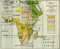 Ger claims Prof Delbruck 1917.jpg 890 × 720; 149 KB
-
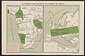 El Imperio que Alemania ha perdido en Africa (5003881).jpg 5,000 × 3,329; 1.47 MB
-
 Sketch map of Northern Portuguese East Africa - btv1b53121073p.jpg 10,360 × 6,246; 5.53 MB
-
 The American Museum Congo expedition collection of bats (1917) (17538698593).jpg 3,616 × 2,092; 2.03 MB
-
 With Botha and Smuts in Africa (1917) (14781543674).jpg 1,566 × 2,394; 504 KB


.jpg)

_(17538698593).jpg)
_(14781543674).jpg)