Category:1920s maps of Cuba
Jump to navigation
Jump to search
Insular countries of the Caribbean: The Bahamas · Cuba · Haiti
Continental countries: Belize · Colombia · Honduras · Mexico · Nicaragua · Panama · Venezuela
Other territories: Puerto Rico
Continental countries: Belize · Colombia · Honduras · Mexico · Nicaragua · Panama · Venezuela
Other territories: Puerto Rico
Media in category "1920s maps of Cuba"
The following 3 files are in this category, out of 3 total.
-
 Admiralty Chart No 1217 Florida Strait South Part, Published 1890, Corrections to 1927.jpg 26,048 × 15,916; 62.7 MB
-
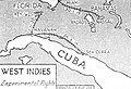 Air Routes of the West Indies in 1925.jpg 876 × 596; 228 KB
-
 Central Hershey Map.jpg 4,655 × 3,284; 3.5 MB


