Category:1920s maps of Schleswig-Holstein
Jump to navigation
Jump to search
|
Federal states of Germany: |
Media in category "1920s maps of Schleswig-Holstein"
The following 8 files are in this category, out of 8 total.
-
 Collier's 1921 Denmark.jpg 1,888 × 2,290; 1.47 MB
-

-
 Abstimmung-schleswig-1920.png 3,403 × 2,315; 193 KB
-
 Abstimmungsgebiet in Schleswig.jpg 5,832 × 7,560; 53.81 MB
-
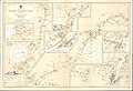 Admiralty Chart No 2469 Kaiser Wilhelm Canal, Published 1920.jpg 16,225 × 11,110; 42.75 MB
-

-
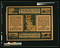 Ist Schleswig dänisch? ... Schleswig ist deutsch! LCCN2004665992.jpg 1,024 × 825; 177 KB
-
 Sonderjylland1918.jpg 4,790 × 5,417; 9.31 MB

_(14777419672).jpg)


