Category:1920s maps of Virginia
Jump to navigation
Jump to search
States of the United States: Alabama · Alaska · Arizona · Arkansas · California · Colorado · Connecticut · Delaware · Florida · Georgia · Hawaii · Idaho · Illinois · Indiana · Iowa · Kansas · Kentucky · Louisiana · Maine · Maryland · Massachusetts · Michigan · Minnesota · Mississippi · Missouri · Nebraska · Nevada · New Hampshire · New Jersey · New Mexico · New York · North Carolina · North Dakota · Ohio · Oklahoma · Pennsylvania · Rhode Island · South Carolina · South Dakota · Tennessee · Texas · Utah · Vermont · Virginia · Washington · West Virginia · Wisconsin · Wyoming – Washington, D.C.
Puerto Rico
Puerto Rico
Subcategories
This category has the following 3 subcategories, out of 3 total.
- 1921 maps of Virginia (4 F)
- 1922 maps of Virginia (5 F)
- 1927 maps of Virginia (2 F)
Media in category "1920s maps of Virginia"
The following 2 files are in this category, out of 2 total.
-
 Map of the vicinity of Richmond, Va. and part of the Peninsula LOC lva0000169.jpg 8,358 × 5,120; 7.61 MB
-
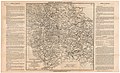
 Rand McNally Map of Virginia.jpg 3,577 × 2,632; 3.61 MB

