Category:1930 maps of Taiwan
Jump to navigation
Jump to search
Countries of Asia: People's Republic of China · India · Thailand · Vietnam
Limited recognition: Taiwan
Limited recognition: Taiwan
| ← 1930 1931 1932 1933 1934 1935 1936 1937 1938 1939 → |
Media in category "1930 maps of Taiwan"
The following 14 files are in this category, out of 14 total.
-
 ChanghuaYuanlinLugangXihuOldmap.jpg 6,328 × 4,494; 4.62 MB
-
 Karikō, Tainan (Nijūmanbun no ichi teikokuzu).jpg 727 × 591; 44 KB
-
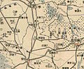
 Map of Beitou springs.jpg 800 × 668; 144 KB
-
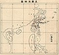 Map of major fishing grounds near Taiwan.jpg 1,486 × 1,397; 348 KB
-
 Map of Shichiko and Anjun Tainan Taiwan.jpg 450 × 450; 35 KB
-
 Taihoku map circa 1930.PNG 1,106 × 1,669; 1.17 MB
-
 Tainan City Scope.jpg 450 × 450; 34 KB
-
 Tainan map circa 1930.PNG 1,098 × 848; 633 KB
-
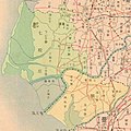
 Tainanshu Kannaizu.jpg 2,260 × 2,794; 676 KB
-
 Takao map circa 1930.PNG 1,101 × 845; 671 KB
-
 Tansui District 1930.png 2,362 × 2,228; 2.98 MB
-
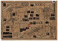
 大甲街地圖.jpg 2,349 × 1,957; 2.55 MB
-
 西市場配置圖.jpg 1,575 × 1,260; 166 KB
-
 鹿港街全圖.jpg 3,746 × 3,225; 3.88 MB

.jpg)


