Category:1930s maps showing history
Jump to navigation
Jump to search
Media in category "1930s maps showing history"
The following 40 files are in this category, out of 40 total.
-
 Polen-Litauen BV044859943.jpg 3,768 × 4,500; 2.79 MB
-
 Siege of Bexar.jpg 930 × 805; 76 KB
-
 Westeuropa BV044859944.jpg 4,500 × 3,991; 2.79 MB
-
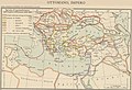
 Zunghar Khanate at 1760.jpg 495 × 553; 99 KB
-
 A map to locate and date the most important events in the history of The Arts.jpg 13,184 × 11,498; 30.89 MB
-
 Das Rhein-Main-Gebiet vor 150 Jahren (1787).jpg 3,856 × 4,687; 7.09 MB
-
 Největší rozmach české moci na rozhraní století XIII. a XIV.jpg 1,472 × 1,467; 534 KB
-
 Náběh Jana Lucemburského k založení české velmoci v druhé třetině století XIV.jpg 1,468 × 1,361; 456 KB
-
 Česká velmoc v druhé polovici století XIV.jpg 1,477 × 1,357; 459 KB
-
 OldCourland.jpg 1,700 × 2,730; 821 KB
-
 Tarile romane sub Mihai Viteazul.jpg 570 × 490; 161 KB
-
 Balkanhalbinsel BV044859947.jpg 3,500 × 4,727; 9.33 MB
-
 Bulgarien BV044859948.jpg 4,500 × 2,995; 6.48 MB
-

-

-
 Balkanhalbinsel BV044859946.jpg 3,500 × 4,691; 9.05 MB
-
 Battle of Shiroyama map.jpg 1,200 × 910; 357 KB
-
 Fort Washington (Cambridge, Massachusetts) - 00000a.tif 9,328 × 7,584; 341 KB
-
 GermanHamletsSince15th.jpg 2,797 × 2,095; 1,020 KB
-
 Historic Florida maps ("Territory of Florida Map 1 1820").gif 1,048 × 1,162; 338 KB
-
 Map Ancient Egypt 1928-1940 - Touring Club Italiano CART-TRC-34.jpg 4,551 × 6,298; 2.78 MB
-
 Map Ancient Palestine 1928-1940 - Touring Club Italiano CART-TRC-36.jpg 4,196 × 6,414; 2.61 MB
-
 Map Italy around 1300- Touring Club Italiano CART-TRC-47.jpg 6,052 × 6,640; 4.72 MB
-
 Map Italy around 500 b.C. - Touring Club Italiano CART-TRC-40.jpg 6,046 × 6,651; 4.22 MB
-
 Map Italy at the time of Augustus- Touring Club Italiano CART-TRC-44.jpg 6,034 × 6,689; 4.97 MB
-
 Map Italy in 1454- Touring Club Italiano CART-TRC-46.jpg 6,135 × 6,668; 4.74 MB
-
 Map Italy in 1559 - Touring Club Italiano CART-TRC-48 01.jpg 3,189 × 4,222; 3 MB
-
 Map Italy in the second half of 10th century- Touring Club Italiano CART-TRC-43 02.jpg 3,013 × 4,100; 1.46 MB
-
 Map Linguistic map of Europe 1928-1940 - Touring Club Italiano CART-TRC-29.jpg 7,491 × 6,356; 27.8 MB
-
 Map Longobard-Byzantine Italy- Touring Club Italiano CART-TRC-43 01.jpg 2,999 × 4,224; 1.48 MB
-
 Map Map of the Persian Empire 1928-1940 - Touring Club Italiano CART-TRC-35.jpg 6,528 × 4,485; 3.45 MB
-

-
 Map Rome in the Imperial Era- Touring Club Italiano CART-TRC-41.jpg 6,646 × 6,366; 3.82 MB
-
 Map The Acropolis of Athens and its slopes 1928-1940 - Touring Club Italiano CART-TRC-37.jpg 8,279 × 6,007; 31.78 MB
-
 Map The decadence of the Ottoman Empire- Touring Club Italiano CART-TRC-45 02.jpg 4,874 × 3,102; 1.82 MB
-

-
 Map The Ottoman Empire- Touring Club Italiano CART-TRC-45 01.jpg 4,877 × 3,317; 1.94 MB
-
 Map The Roman Empire under Trajan and Adrian- Touring Club Italiano CART-TRC-42.jpg 6,816 × 5,069; 4.02 MB
-
 Qing Dynasty 1760.jpg 2,702 × 2,400; 1.08 MB
-
 Russland BV044859942.jpg 3,568 × 4,500; 2.74 MB


.jpg)


.jpg)
.jpg)


.gif)


