Category:1935 maps of Iowa
Jump to navigation
Jump to search
States of the United States: Idaho · Illinois · Iowa · Louisiana · Maine · Michigan · Minnesota · Mississippi · North Dakota · Rhode Island · Washington · Wisconsin – Washington, D.C.
| ← 1930 1931 1932 1933 1934 1935 1936 1937 1939 → |
Media in category "1935 maps of Iowa"
The following 16 files are in this category, out of 16 total.
-
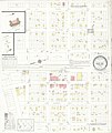
 Sanborn Fire Insurance Map from Ashton, Osceola County, Iowa. LOC sanborn02569 002.jpg 6,450 × 7,650; 2.9 MB
-
 Sanborn Fire Insurance Map from Ashton, Osceola County, Iowa. LOC sanborn02569 002.tiff 6,450 × 7,650; 141.17 MB
-
 Sanborn Fire Insurance Map from Moorhead, Monona County, Iowa. LOC sanborn02754 002.jpg 6,450 × 7,650; 2.91 MB
-
 Sanborn Fire Insurance Map from Moorhead, Monona County, Iowa. LOC sanborn02754 002.tif 6,450 × 7,650; 141.17 MB
-
 Sanborn Fire Insurance Map from Elgin, Fayette County, Iowa. LOC sanborn02646 003.jpg 6,450 × 7,650; 3.58 MB
-
 Sanborn Fire Insurance Map from Kellogg, Jasper County, Iowa. LOC sanborn02700 003.jpg 6,450 × 7,650; 3.57 MB
-
 Sanborn Fire Insurance Map from Kellogg, Jasper County, Iowa. LOC sanborn02700 003.tif 6,450 × 7,650; 141.17 MB
-
 Sanborn Fire Insurance Map from Mondamin, Harrison County, Iowa. LOC sanborn02748 002.jpg 6,450 × 7,650; 3.63 MB
-
 Sanborn Fire Insurance Map from Shelby, Shelby County, Iowa. LOC sanborn02821 007.jpg 6,450 × 7,650; 3.32 MB
-
 Sanborn Fire Insurance Map from Shelby, Shelby County, Iowa. LOC sanborn02821 007.tif 6,450 × 7,650; 141.17 MB
-
 Sanborn Fire Insurance Map from Shell Rock, Butler County, Iowa. LOC sanborn02823 004.jpg 6,450 × 7,650; 3.63 MB
-
 Sanborn Fire Insurance Map from Shell Rock, Butler County, Iowa. LOC sanborn02823 004.tif 6,450 × 7,650; 141.17 MB
-
 Sanborn Fire Insurance Map from Stratford, Hamilton County, Iowa. LOC sanborn02839 003.jpg 6,450 × 7,650; 2.99 MB
-
 Sanborn Fire Insurance Map from Stratford, Hamilton County, Iowa. LOC sanborn02839 003.tif 6,450 × 7,650; 141.17 MB
-
 Sanborn Fire Insurance Map from Tripoli, Bremer County, Iowa. LOC sanborn02849 002.jpg 6,450 × 7,650; 3.8 MB
-
 Sanborn Fire Insurance Map from Tripoli, Bremer County, Iowa. LOC sanborn02849 002.tif 6,450 × 7,650; 141.17 MB


