Category:1940 maps of Massachusetts
Jump to navigation
Jump to search
States of the United States: Alaska · Arizona · California · Colorado · Florida · Georgia · Illinois · Iowa · Louisiana · Massachusetts · Michigan · Missouri · Montana · New Hampshire · New Mexico · New York · North Carolina · North Dakota · Ohio · Oregon · Pennsylvania · South Carolina · Tennessee · Texas · Washington
| 1940 → |
Subcategories
This category has only the following subcategory.
1
Media in category "1940 maps of Massachusetts"
The following 4 files are in this category, out of 4 total.
-
 1940 BERy Owl service map (colors).png 3,195 × 3,223; 8.28 MB
-
 1940 BERy Owl service map.png 3,500 × 3,510; 17.81 MB
-
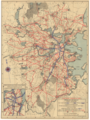 1940 Boston Elevated Railway system map.png 3,500 × 4,661; 35.53 MB
-

.png)


