Category:1940s maps of Europe
Jump to navigation
Jump to search
Temperate regions: North America · South America · Africa · Europe · Asia · Oceania – Polar regions: – Other regions:
Subcategories
This category has the following 43 subcategories, out of 43 total.
A
B
C
- 1940s maps of the Caucasus (7 F)
D
E
- 1940s maps of Eastern Europe (6 F)
F
G
H
I
- 1940s maps of Iceland (9 F)
L
N
P
R
S
T
U
Media in category "1940s maps of Europe"
The following 5 files are in this category, out of 5 total.
-

-
 Blake Britain Spearhead of Attack.jpg 10,105 × 6,646; 48.23 MB
-
 Fotothek df pk 0000314 018 Pfingsten 1947.jpg 800 × 519; 109 KB
-
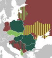 International Peasant Union.svg 840 × 930; 419 KB
-
 The Invasion of Normandy 1944 B5157.jpg 798 × 800; 80 KB
_orographique_(relief_du_sol)_-_dress%C3%A9e_par_J._Forest..._-_btv1b531970533.jpg)


