Category:1946 maps of the United Kingdom
Jump to navigation
Jump to search
Countries of Europe: Bulgaria · France‡ · Germany · Italy · Norway · Spain‡ · Switzerland · Turkey‡ · Ukraine · United Kingdom
‡: partly located in Europe
‡: partly located in Europe
Media in category "1946 maps of the United Kingdom"
The following 3 files are in this category, out of 3 total.
-
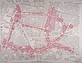 Map from Birmingham Corporation Inner Ring Road Key Plan, 1946.jpg 4,096 × 3,140; 2.52 MB
-
 Ordnance Survey One-Inch Sheet 123 Spalding, Published 1946.jpg 10,924 × 12,746; 14.15 MB
-
 Ordnance Survey One-Inch Sheet 134 Huntingdon & Peterborough, Published 1946.jpg 10,967 × 12,765; 14.72 MB


