Category:1948 maps of North America
Jump to navigation
Jump to search
Temperate regions: North America · South America · Africa · Europe · Asia · – Polar regions: – Other regions:
English: 1948 maps of North America
Subcategories
This category has the following 6 subcategories, out of 6 total.
Media in category "1948 maps of North America"
The following 3 files are in this category, out of 3 total.
-
 America do Norte politica. 1 - 10.000.000 - desenhado por J. Forest... - btv1b53195382b.jpg 15,864 × 12,135; 32.65 MB
-

-
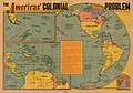 The Americas' colonial problem, 1948.jpg 2,387 × 1,675; 1.32 MB


