Category:1955 maps of Canada
Jump to navigation
Jump to search
Countries of North America: Canada · Cuba · United States of America‡
‡: partly located in North America
‡: partly located in North America
| ← 1950 1951 1953 1954 1955 1956 1957 1958 |
English: Maps of Canada from 1955 or related to Canada in 1955
Français : Les cartes du Canada de 1955 ou se rapportant au Canada en 1955
Media in category "1955 maps of Canada"
The following 3 files are in this category, out of 3 total.
-
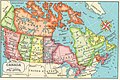 Canada 55.jpg 819 × 549; 218 KB
-
 Contour map of Dixon Entrance.png 1,526 × 1,544; 808 KB
-
 Dvp proposed.svg 350 × 1,020; 526 KB

