Category:1970s maps of Finland
Jump to navigation
Jump to search
Countries of Europe: Armenia‡ · Azerbaijan‡ · Belarus · Denmark · Estonia · Finland · France‡ · Germany · Greece · Iceland · Republic of Ireland · Italy · Lithuania · Netherlands‡ · Norway · Portugal‡ · Romania · Russia‡ · Spain‡ · Sweden · Switzerland · Turkey‡ · Ukraine · United Kingdom
‡: partly located in Europe
‡: partly located in Europe
Media in category "1970s maps of Finland"
The following 4 files are in this category, out of 4 total.
-
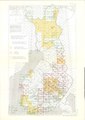 Suomen taloudellisen kartan kattavuus.pdf 1,752 × 2,479; 1.34 MB
-
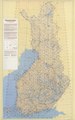 Suomen Yleislehtijakokartta 1975.pdf 4,406 × 7,075; 6.91 MB
-
 Rauma P-34 XXVII XXVIII 1976.tif 7,150 × 5,497; 113.09 MB
-
 Operational Navigation Chart D-2, 7th edition.jpg 9,254 × 6,633; 17.41 MB
