Category:1975 maps of Florida
Jump to navigation
Jump to search
States of the United States: Florida · Georgia · Hawaii · Louisiana · Maine · New Jersey · North Carolina · Ohio · Oklahoma · Texas · West Virginia – Washington, D.C.
| ← 1971 1972 1973 1974 1975 1976 1977 1978 1979 → |
Media in category "1975 maps of Florida"
The following 8 files are in this category, out of 8 total.
-
 Central and southern Florida flood control project LOC 2010589005.jpg 3,878 × 5,807; 3.87 MB
-
 Central and southern Florida flood control project LOC 2010589005.tif 3,878 × 5,807; 64.43 MB
-
 Everglades National Park, Florida. LOC 78693090.jpg 4,920 × 6,819; 4.85 MB
-
 Everglades National Park, Florida. LOC 78693090.tif 4,920 × 6,819; 95.99 MB
-
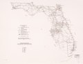
 Transportation map of Florida. LOC 77694775.jpg 6,575 × 5,053; 3.32 MB
-
 Transportation map of Florida. LOC 77694775.tif 6,575 × 5,053; 95.05 MB
-
 Transportation map of Florida. LOC 77694824.jpg 6,579 × 5,072; 3.4 MB
-
 Transportation map of Florida. LOC 77694824.tif 6,579 × 5,072; 95.47 MB

