Category:1976 maps of Greenland
Jump to navigation
Jump to search
Countries of North America: The Bahamas · Canada · Costa Rica · Panama · United States of America‡
Other territories: Bermuda · Greenland
‡: partly located in North America
Other territories: Bermuda · Greenland
‡: partly located in North America
| 1976 |
Media in category "1976 maps of Greenland"
The following 5 files are in this category, out of 5 total.
-
 Chart C-13.jpg 8,493 × 5,422; 20.9 MB
-
 Greenland. LOC 2005626483.jpg 2,442 × 3,192; 567 KB
-
 Greenland. LOC 2005626483.tif 2,442 × 3,192; 22.3 MB
-
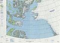 Operational Navigation Chart B-8, 3rd edition.jpg 9,254 × 6,634; 14.14 MB
-
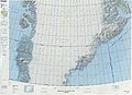 Operational Navigation Chart C-13, 3rd edition.jpg 9,254 × 6,716; 15.77 MB


