Category:1999 Atlantic hurricane season track maps
Jump to navigation
Jump to search
Media in category "1999 Atlantic hurricane season track maps"
The following 19 files are in this category, out of 19 total.
-
1999 Atlantic hurricane season summary map.png 4,000 × 2,476; 6.1 MB
-
Bret 1999 track.png 2,700 × 1,669; 3.7 MB
-
Cindy 1999 track.png 2,700 × 2,009; 396 KB
-
Dennis 1999 track.png 2,700 × 2,040; 3.9 MB
-
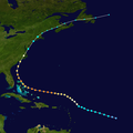
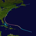
Floyd 1999 track.png 2,700 × 2,694; 3.26 MB
-
Floyd 1999 path.png 2,700 × 2,694; 3.51 MB
-
Gert 1999 track.png 2,700 × 2,439; 596 KB
-
Irene 1999 track.png 2,700 × 2,506; 3.17 MB
-
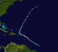
Jose 1999 path.png 2,700 × 2,410; 679 KB
-
Jose 1999 track.png 2,700 × 2,412; 1.9 MB
-
Lenny 1999 track.png 2,700 × 1,669; 1.92 MB
-
11-L 1999 track.png 2,700 × 1,669; 2.86 MB
-
7-L 1999 track.png 2,700 × 1,669; 3.6 MB
-
12-L 1999 track.png 2,700 × 1,669; 817 KB
-
2-L 1999 track.png 2,700 × 1,669; 2.97 MB
-
Arlene 1999 track.png 2,700 × 1,669; 1.07 MB
-
Emily 1999 track.png 2,700 × 1,669; 1.17 MB
-
Harvey 1999 track.png 2,700 × 1,669; 3.23 MB
-
Katrina 1999 track.png 2,700 × 1,669; 2.63 MB


