Category:19th-century maps of Dieppe
Jump to navigation
Jump to search
Media in category "19th-century maps of Dieppe"
The following 8 files are in this category, out of 8 total.
-
 CDF Dieppe gare carte.jpg 3,504 × 2,548; 7.72 MB
-

-

-

-
 Plan de l'embarcadère projeté de la gare de Dieppe - lith. Em. Delavoye - btv1b53087716v.jpg 5,088 × 3,480; 1.97 MB
-

-
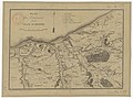 Plan des environs de la ville de Dieppe - btv1b8439547t.jpg 4,992 × 3,718; 3.02 MB
-
 Plan des environs de la ville de Dieppe - btv1b8440725d.jpg 6,215 × 4,379; 4.51 MB

_(14589549770).jpg)
_(14783728712).jpg)


