Category:19th-century maps of Funchal
Jump to navigation
Jump to search
Subcategories
This category has only the following subcategory.
Media in category "19th-century maps of Funchal"
The following 10 files are in this category, out of 10 total.
-
 IMRAY(1884) p0108 MADEIRA, FUNCHAL BAY.jpg 3,587 × 2,680; 5.45 MB
-
 TAYLOR(1889) A Plan of the City of Funchal.jpg 2,140 × 1,411; 1.99 MB
-
 23 of 'The Madeira Islands, etc. (With plates and maps.)' (11236786946).jpg 1,936 × 1,276; 1.01 MB
-

-
 Admiralty Chart No 1689 Funchal, Surveyed 1843.jpg 9,843 × 7,580; 9.69 MB
-
 Palácio de Nuno de Freitas, c. 1800.jpg 550 × 556; 90 KB
-
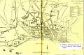 Plan of Funchal, published by Ellen M. Taylor, 1882.jpg 1,100 × 727; 139 KB
-
 Planta do Funchal, Paulo Dias de Almeida, 1823 a 1827.jpg 413 × 650; 27 KB
-

-

_p0108_MADEIRA,_FUNCHAL_BAY.jpg)
_A_Plan_of_the_City_of_Funchal.jpg)
%27_(11236786946).jpg)
.jpg)


