Category:19th-century maps of Göteborg
Jump to navigation
Jump to search
Media in category "19th-century maps of Göteborg"
The following 79 files are in this category, out of 79 total.
-
 1809 Göteborg.djvu 10,698 × 7,616; 827 KB
-
 1815 Plan över Göteborg.djvu 11,316 × 8,601; 1.09 MB
-
 1815 Stora Torp.djvu 11,938 × 22,540; 1.61 MB
-
 1817 Lindholmens säteri.djvu 4,282 × 6,620; 177 KB
-
 1820 Tingstads by.djvu 9,892 × 7,800; 454 KB
-
 1826 Göteborgs tegelbruk.djvu 15,117 × 10,746; 693 KB
-
 Klippan-1827.png 603 × 976; 873 KB
-
 1827 Klippan.djvu 3,061 × 4,961; 104 KB
-
 1829 Tingstads by.djvu 17,154 × 11,174; 749 KB
-
 1831 Kronohospitalet.djvu 7,977 × 12,093; 542 KB
-
 1836 Tingstads by.djvu 15,508 × 8,180; 345 KB
-
 1840 Klippan.djvu 12,114 × 9,111; 231 KB
-
 1844 Örgryte socken.djvu 21,472 × 11,580; 659 KB
-
 1844 Östra Klippan.djvu 13,707 × 16,527; 383 KB
-
 1845 Wallgraven, lilla Bommen.djvu 15,840 × 12,486; 500 KB
-
 1846 Stora och lilla klippan.djvu 15,146 × 12,204; 405 KB
-
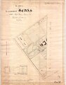 1853 Landeriet Hedås.djvu 12,114 × 15,486; 804 KB
-
 1855 Karta över Kungsparken.djvu 15,753 × 13,917; 491 KB
-
 1855 Lägenheter Östra Haga.djvu 12,957 × 12,483; 601 KB
-
 1855 Olskroken.djvu 11,072 × 9,128; 488 KB
-
 1857 Del av sjöhamnen.djvu 10,503 × 14,202; 437 KB
-
 1863 Syrhåla by.djvu 24,312 × 11,040; 1.08 MB
-
 1864 Förslag på plan över Göteborgs utvidgning.djvu 25,266 × 17,604; 1.93 MB
-
 1865 Böö och Gårda.djvu 10,658 × 21,800; 733 KB
-
 1865 Göteborgs hamn och rivier samt jernvägsspår.djvu 29,898 × 12,117; 1.41 MB
-
 1866 Exercis Heden.djvu 18,294 × 14,313; 1.01 MB
-
 1867 Göteborgs utvidgning norra delen.djvu 15,462 × 21,489; 1.49 MB
-
 1869 Tomt- och adresskarta Göteborg.djvu 7,016 × 5,390; 545 KB
-
 1871 Getebergsängen vid landeriet Liseberg.djvu 9,288 × 19,875; 585 KB
-
 1872 Göteborg.djvu 16,410 × 6,489; 1.83 MB
-
 1872 Innerstaden.djvu 5,964 × 4,365; 671 KB
-
 1872 Nordvestra delen af Gullbergswass.djvu 20,034 × 14,337; 786 KB
-
 1873 Heden, femtonde roten.djvu 6,309 × 10,881; 990 KB
-
 1873 Landeriet Christinedal.djvu 13,410 × 16,260; 667 KB
-
 1873 Sannegården.djvu 12,812 × 9,160; 306 KB
-
 1877 Landala och Gibraltar.djvu 8,948 × 7,798; 437 KB
-
 1878 Vädersågen.djvu 6,298 × 8,693; 289 KB
-
 CEDERBLAD(1884) Map of Göteborg.jpg 1,900 × 1,567; 1.43 MB
-
 1885 Vasastaden.djvu 4,923 × 6,521; 162 KB
-
 1891 Skår.djvu 8,886 × 19,858; 500 KB
-
-
-
 Admiralty Chart No 2114 The Kattegat, Denmark and Sweden, Published 1852.jpg 8,362 × 12,248; 14.58 MB
-
 Alla Tomter och Lägenheter uti För. Staden Masthugget Götheborg Författad Åren 1815 och 1816.tif 17,688 × 11,088; 561.07 MB
-
 Belägenheten Omkring Göteborg Utgiven Af N. G. Werming 1809. Graverad af E. Åkerlund.tif 10,698 × 7,616; 234.93 MB
-
 BillingenRya1809.jpg 2,835 × 2,134; 908 KB
-
 Carta öfwer Krono Amiralitets Warfwet 1818.tif 4,846 × 5,803; 80.46 MB
-
 Charta Öfver Den Så Kallade Busckiska Repslagare-Banan 1808.tif 5,600 × 7,631; 122.26 MB
-
 Göteborg 1890, skala 1 till 10000.jpg 8,576 × 7,110; 8.31 MB
-
 Göteborg 1890, skala 1 till 4000.jpg 8,594 × 7,110; 15.83 MB
-
 Göteborg 1900, skala 1 till 10000.jpg 8,581 × 7,110; 7.49 MB
-
 Göteborg map 1862.jpg 2,018 × 1,500; 2.65 MB
-

-
 Götheborg 1880, skala 1 till 10000.jpg 8,608 × 7,120; 6.93 MB
-
 Götheborg 1880, skala 1 till 4000.jpg 8,570 × 7,072; 14.51 MB
-
 Götheborg omkring 1820.jpg 7,062 × 8,594; 17.44 MB
-
 Götheborg omkring 1860.jpg 7,072 × 8,574; 15.77 MB
-
 Götheborgs Revier af Götha Elfs Utlopp 1816.tif 4,523 × 4,244; 54.92 MB
-

-

-
 Karta öfver Göteborg sammandragen efter äldre och nyare kartor år 1872 af Rob. Söderqvist.tif 16,410 × 6,489; 305.7 MB
-

-

-
 Karta öfver Situationerne kring Göteborg och Bohus.jpg 7,686 × 9,894; 6.55 MB
-

-

-
 Map Goteborg Lindgren 1815.jpg 5,448 × 2,288; 828 KB
-
 Map, karta-Göteborg 1866 - Göteborgs stadsmuseum - GMA 8823.tif 5,692 × 4,299; 70.03 MB
-
 NyaAlvsborg1811.jpg 7,708 × 9,796; 3.88 MB
-
 NyaVarvet Map Goteborg Lindgren 1815.jpg 1,074 × 835; 189 KB
-
 NyaVarvet1815-01.jpg 3,508 × 2,103; 1,022 KB
-
 Plan af Batterierne Billingen.jpg 9,822 × 7,571; 2.67 MB
-
 Plan af Batterierne Rya Nabbe.jpg 9,826 × 7,553; 4.32 MB
-

-
 Proposed extension of Gothenburg city Nya Allén 1857 - part 1.jpg 14,030 × 8,328; 40.71 MB
-
 Simon's 1888 Gothenburg map (cropped).tiff 800 × 800; 1.86 MB
-
 Simon's 1888 Gothenburg map.jpg 13,780 × 6,439; 37.78 MB
-
 Simon's 1888 Gothenburg map.tiff 13,780 × 6,439; 253.89 MB
-
 Werming Göteborg.png 3,971 × 2,780; 16.22 MB

_Map_of_G%C3%B6teborg.jpg)
.jpg)


.jpg)