Category:19th-century maps of Gelderland
Jump to navigation
Jump to search
Provinces of the Netherlands: Drenthe · Friesland · Gelderland · Groningen · North Brabant · North Holland · Overijssel · South Holland · Zeeland
Subcategories
This category has only the following subcategory.
G
Media in category "19th-century maps of Gelderland"
The following 18 files are in this category, out of 18 total.
-
 Abcontrafeitung der Stat Bommel (BM 1872,0113.617).jpg 2,500 × 1,877; 1.52 MB
-
 Gelegenheit des Bommeler Wehrts vnd der Schenckischen Schanzen. (BM 1880,0710.348).jpg 2,500 × 1,510; 772 KB
-

-
 DeSlaperdijk1815.jpg 627 × 888; 556 KB
-
 Kaart elburg 1867.jpg 2,050 × 2,671; 1.36 MB
-
 Ausschnitt Didam aus Provgelderland (1867).jpg 789 × 624; 316 KB
-
 Ede1 Doesburger molen.png 1,599 × 1,196; 475 KB
-
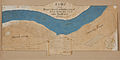
 Boven ijssel Gelderland 1810.jpg 1,234 × 937; 1.73 MB
-
 Bredenweerd en Richtersweerd (1804).jpg 5,346 × 2,694; 3.05 MB
-
 Broeke (Neede) 1818.jpg 676 × 693; 111 KB
-
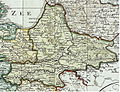 Departement gelderland 1802.jpg 1,232 × 948; 1.52 MB
-
 Kaart Geesteren met huis- en boerderijnamen ECAL 1835 1394-40.jpg 5,222 × 7,390; 12.13 MB
-
 Kaart Gelselaar met huis- en boerderijnamen 1835 ECAL 1394-41.jpg 11,902 × 6,146; 18.89 MB
-
 Landgoed Morren 1847.jpg 440 × 326; 22 KB
-
 Netherlands, Nederhemert, map of 1867.jpg 1,200 × 1,504; 524 KB
-
 Netherlands, Ophemert, map of 1865.jpg 1,300 × 1,136; 633 KB
-
 Wageningent 1830-1850 tmk nettekening.jpg 4,004 × 2,517; 4.02 MB
-
 Wilp1832.jpg 3,057 × 575; 370 KB
.jpg)
.jpg)
_(BM_1870,1112.223).jpg)


.jpg)


.jpg)
_1818.jpg)


