Category:19th-century maps of Rio de Janeiro
Jump to navigation
Jump to search
Edward Gotto's Plan of the city of Rio de Janeiro (1871)
Media in category "19th-century maps of Rio de Janeiro"
The following 19 files are in this category, out of 19 total.
-
 BARROW(1806) p172 RIO DE JANEIRO.jpg 2,177 × 1,480; 1.71 MB
-
 Planta da provincia do Rio de Janeiro, 1830.png 11,610 × 8,159; 233.94 MB
-

-
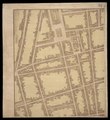
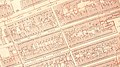 Rua de S Pedro from the Gotto Plan of Rio de Janeiro 1871 stitched.jpg 1,280 × 720; 462 KB
-
-

-
 IMRAY(1884) p0878 RIO DE JANEIRO.jpg 2,747 × 3,791; 5.04 MB
-

-
 227 of 'A Revolta da armada de 6de Setembro de 1893' (11228407114).jpg 3,085 × 4,096; 2.8 MB
-

-

-
-
 Admiralty Chart No 541 Rio De Janeiro Harbour, Published 1858.jpg 8,486 × 12,021; 13.27 MB
-
 Edward Gennys Fanshawe, Chart of the harbour of Rio de Janeiro, Brazil.jpg 995 × 1,280; 919 KB
-
 Gotto Plan of Rio de Janeiro 1871 Cart326448.pdf 10,668 × 7,035, 31 pages; 51.17 MB
-
 Mappa architectural do Rio de Janeiro.pdf 2,339 × 2,547, 5 pages; 1.84 MB
-
 Plano da cidade do Rio de Janeiro elevado em 1791.jpg 4,277 × 2,774; 1.71 MB
-
 Planta Da Cidade Do Rio De Janeiro e Suburbios.jpg 19,124 × 16,872; 48.79 MB
-
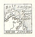
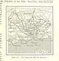
 Rio-de-Janeiro-Brockhaus-Konversationslexikon-1895.jpg 890 × 579; 236 KB
_p172_RIO_DE_JANEIRO.jpg)

.jpg)

.jpg)
.jpg)
_p0878_RIO_DE_JANEIRO.jpg)
.jpg)
.jpg)
.jpg)
.jpg)
.jpg)


