Category:19th-century maps of Saarland
Jump to navigation
Jump to search
Federal states of Germany:
Subcategories
This category has the following 4 subcategories, out of 4 total.
- 1860s maps of Saarland (1 F)
Media in category "19th-century maps of Saarland"
The following 4 files are in this category, out of 4 total.
-
 Bahnstrecke voeklingen grube puettlingen 1882.JPG 1,614 × 1,245; 607 KB
-
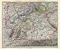
 Saarbruckenmap.jpg 1,500 × 1,319; 338 KB
-
 Stielers Handatlas 1891 12.jpg 5,199 × 4,250; 8.49 MB
-
 Stielers Handatlas 1891 15.jpg 5,099 × 4,250; 8.02 MB


