Category:19th-century maps of the Black Sea
Jump to navigation
Jump to search
Subcategories
This category has the following 10 subcategories, out of 10 total.
- 1800s maps of the Black Sea (12 F)
- 1820s maps of the Black Sea (15 F)
- 1840s maps of the Black Sea (11 F)
- 1850s maps of the Black Sea (33 F)
- 1870s maps of the Black Sea (14 F)
- 1880s maps of the Black Sea (20 F)
- 1890s maps of the Black Sea (6 F)
Media in category "19th-century maps of the Black Sea"
The following 17 files are in this category, out of 17 total.
-
 Stielers Handatlas 1891 cropped. Caucasus and Middle East.jpg 1,012 × 721; 321 KB
-
 10 of 'Autour de la Méditerranée ... Illustrations par A. Chapon, etc' (11215391434).jpg 3,008 × 2,027; 1.82 MB
-
 Meyers leiner Hand-atlas 1893 (73136905).jpg 6,408 × 5,106; 6.78 MB
-
 Venice - an historical sketch of the republic (1893) (14595506768).jpg 1,268 × 2,894; 199 KB
-

-

-
 19th century - Russian nautical chart of the Black Sea.jpg 11,687 × 7,834; 7.81 MB
-

-

-

-

-
 Conduc Sagani Alibei.jpg 862 × 834; 243 KB
-
 Das Mittelländische und Schwarze Meer Nebst Übersicht Der Länder Des Osmanischen Reichs.jpg 5,607 × 4,581; 8.62 MB
-
 Limanul Nistrului.jpg 840 × 1,142; 294 KB
-
 Ports de la mer Noire (34512311126).jpg 6,744 × 5,641; 22.4 MB
-

-
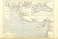
 Region of the Wars with Mithridates.png 718 × 421; 192 KB

.jpg)
.jpg)
_(14595506768).jpg)
%27_(11232818726).jpg)
%27_(11248397813).jpg)


%27_(11223373275).jpg)


.jpg)
