Category:19th century topographic maps of Haut-Rhin
Jump to navigation
Jump to search
Media in category "19th century topographic maps of Haut-Rhin"
The following 9 files are in this category, out of 9 total.
-
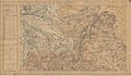
 Carte d'État-major de la France, Feuille Colmar N.O.jpg 21,283 × 14,110; 81.27 MB
-
 Carte d'État-major de la France, Feuille Colmar S.E.jpg 21,969 × 14,482; 62.1 MB
-
 Carte d'État-major de la France, Feuille Colmar S.O.jpg 21,969 × 14,529; 89.44 MB
-
 Carte d'État-major de la France, Feuille Ferrette N.E.jpg 24,094 × 13,736; 68.61 MB
-
 Carte d'État-major de la France, Feuille Ferrette N.O.jpg 24,094 × 13,739; 92.58 MB
-
 Carte d'État-major de la France, Feuille Mulhouse N.E.jpg 23,150 × 13,593; 65.38 MB
-
 Carte d'État-major de la France, Feuille Mulhouse N.O.jpg 22,842 × 13,618; 90.83 MB
-
 Carte d'État-major de la France, Feuille Mulhouse S.E.jpg 23,150 × 13,612; 65.67 MB
-
 Carte d'État-major de la France, Feuille Mulhouse S.O.jpg 23,150 × 13,590; 96.03 MB


