Category:2004 U.S. presidential election maps, county subdivisions
Jump to navigation
Jump to search
Subcategories
This category has the following 2 subcategories, out of 2 total.
Media in category "2004 U.S. presidential election maps, county subdivisions"
The following 16 files are in this category, out of 16 total.
-
 2004 Presidential Election by County.svg 555 × 352; 1.75 MB
-
 2004 United States presidential election results map by county.svg 555 × 352; 1.47 MB
-
 2004 US elections purple counties.png 696 × 436; 136 KB
-
 2004 USA election by county map percentage.PNG 1,513 × 983; 204 KB
-
 2004prescountymap2.PNG 1,513 × 983; 195 KB
-
 Cartlinearlarge.png 701 × 448; 185 KB
-
 Countycartlinear1280x1024.png 1,280 × 1,024; 350 KB
-
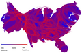
 Gastner map purple byarea bycounty.png 696 × 436; 132 KB
-
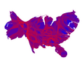
 Gastner map redblue byarea bycounty.png 702 × 435; 85 KB
-
 Gastner map redblue bypopulation bycounty.png 700 × 448; 89 KB
-
 Presidential Elections 2000-2004 Swing in County Margins.svg 555 × 352; 1.73 MB
-
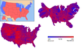 United States 2004 election maps.png 717 × 449; 131 KB
-
 US Election04-08shift.png 1,583 × 1,016; 84 KB
-
 US Election04-08shift.svg 990 × 765; 16.08 MB
-
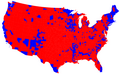
 US presidential election 2004 results by county medium.jpg 769 × 531; 144 KB
-
 US presidential election 2004 results by county.jpg 1,537 × 1,061; 554 KB


