Category:2007 aerial photographs of the United States
Jump to navigation
Jump to search
English: 2007 aerial photographs of the United States
Svenska: Flygfotografier från USA 2007
Deutsch: Luftbildfotografien aus die Vereinigte Staaten von Amerika von 2007
Media in category "2007 aerial photographs of the United States"
The following 45 files are in this category, out of 45 total.
-
 051207-MPLS-007Strib.jpg 1,572 × 596; 784 KB
-
 2007 01 23 - 185@192 in Kensington NW.JPG 2,592 × 1,944; 1.49 MB
-
 2007 01 23 - 185@192@547 in Kensington S 1.JPG 2,592 × 1,944; 1.52 MB
-
 2007 01 23 - 185@192@547 in Kensington S 2.JPG 2,592 × 1,944; 1.48 MB
-
 2007 01 23 - 185@192@547 in Kensington SW 1.JPG 2,592 × 1,944; 1.54 MB
-
 2007 01 23 - 185@192@547 in Kensington SW 2.JPG 2,592 × 1,944; 1.48 MB
-
 2007 01 23 - 29@Randolph-CherryHill - Aerial 02 (north is bottom-right).JPG 2,592 × 1,944; 1.04 MB
-
 2007 01 23 - 355@495 - SB.JPG 2,592 × 1,944; 1.44 MB
-
 2007 01 23 - 547 entering Kensington E.JPG 2,592 × 1,944; 1.42 MB
-
 2007 01 23 - 547 entering Kensington SE 1.JPG 2,592 × 1,944; 1.5 MB
-
 2007 01 23 - 547 entering Kensington SE 2.JPG 2,592 × 1,944; 1.47 MB
-
 2007 01 23 - 97@192 - Aerial looking S to SilverSpring.JPG 2,592 × 1,944; 1.43 MB
-

-

-
 2007 01 23 - MD 650 in White Oak.JPG 2,592 × 1,944; 1.33 MB
-
 2007 01 23 - Sam Eig looking south toward MD 119 a.JPG 2,592 × 1,944; 1.28 MB
-
 2007 01 23 - Sam Eig looking south toward MD 119 b.JPG 2,592 × 1,944; 1.35 MB
-
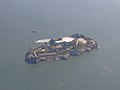 Alcatraz from the Air with Ferries.jpg 1,409 × 1,056; 882 KB
-
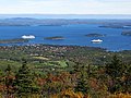 Bar Harbor Maine aerial.jpg 1,600 × 1,200; 486 KB
-
 Bluewater Bridge, aerial view.JPG 2,028 × 1,352; 1.21 MB
-
 Browns Valley flood 07.jpg 2,400 × 1,800; 609 KB
-
 Downtown Minneapolis (1629159974).jpg 3,168 × 809; 1.02 MB
-
 Fairfield CT aerial Pine Creek.jpg 3,504 × 2,336; 8.96 MB
-
 Keene airport.jpg 1,024 × 768; 638 KB
-
 Massena airport.JPG 1,600 × 1,200; 1.25 MB
-
 Orcas Island aerial view EPA photo.jpg 1,600 × 1,064; 380 KB
-
 P1170407 (457578017).jpg 2,560 × 1,920; 1.67 MB
-
 P1170413 (457578039).jpg 2,560 × 1,920; 1.34 MB
-
 Philadelphia approach in fog (508361713).jpg 2,360 × 1,596; 303 KB
-
 Philadelphia through cloud and fog (508361705).jpg 2,560 × 1,920; 538 KB
-
 Philadelphia through the fog (508361717).jpg 2,094 × 1,532; 224 KB
-
 Port Allegany High School.jpg 600 × 438; 56 KB
-
 Queens University of Charlotte.jpg 1,024 × 741; 341 KB
-
 Rutland airport.JPG 3,072 × 2,304; 3.46 MB
-
 San Francisco-Oakland Bay Bridge, helicopter view 1.jpg 649 × 874; 239 KB
-
 San Francisco-Oakland Bay Bridge, helicopter view 2.jpg 768 × 626; 259 KB
-
 San Francisco-Oakland Bay Bridge, helicopter view 3.jpg 1,024 × 768; 210 KB
-
 San Francisco-Oakland Bay Bridge, helicopter view 4-edit.jpg 650 × 445; 265 KB
-
 San Francisco-Oakland Bay Bridge, helicopter view 4.jpg 760 × 899; 323 KB
-
 Saranac Lake airport.JPG 3,072 × 2,304; 3.3 MB
-
 Sartell.JPG 2,592 × 1,944; 2.13 MB
-
 Surface Parking Lot, Downtown Minneapolis (433836865).jpg 2,304 × 2,304; 5.25 MB
-
 Washburn from the air 2007.jpg 3,072 × 2,304; 668 KB
-
 Whittier Narrows Dam Aerial.JPG 1,847 × 1,207; 911 KB
-
 Wilmington Delaware aerial view.jpg 3,264 × 2,448; 4.12 MB


.JPG)


_and_MD119_(background)_01.JPG)
_and_MD119_(background)_02.JPG)


.jpg)
.jpg)
.jpg)
.jpg)
.jpg)


.jpg)


.jpg)