Category:2009 on Tramlink
Jump to navigation
Jump to search
Media in category "2009 on Tramlink"
The following 200 files are in this category, out of 282 total.
(previous page) (next page)-
 *sigh* (3845582267).jpg 2,358 × 671; 131 KB
-
 Changing Times (2) - geograph.org.uk - 1241376.jpg 640 × 360; 70 KB
-
 Tram at Reeves Corner, Croydon - geograph.org.uk - 1185983.jpg 3,072 × 1,728; 2.11 MB
-
 Tram at Sandilands - geograph.org.uk - 1192546.jpg 1,728 × 3,072; 1.81 MB
-
 Tram and depot near Therapia Lane - geograph.org.uk - 1203717.jpg 640 × 480; 149 KB
-
 Tram at Waddon New Road - geograph.org.uk - 1205521.jpg 640 × 480; 70 KB
-
 Tram at West Croydon - geograph.org.uk - 1209586.jpg 640 × 480; 86 KB
-
 East Croydon Tram Stop - geograph.org.uk - 1230173.jpg 640 × 361; 65 KB
-
 Tram at Reeves Corner, Croydon - geograph.org.uk - 1238898.jpg 640 × 480; 101 KB
-
 Trams Pass in Addiscombe Road - geograph.org.uk - 1253938.jpg 3,072 × 2,304; 2.32 MB
-
 Dundonald Road tramstop entrance.JPG 1,600 × 1,200; 445 KB
-
 Dundonald Road tramstop level crossing look north.JPG 1,600 × 1,200; 459 KB
-
 Dundonald Road tramstop level crossing look south.JPG 1,600 × 1,200; 459 KB
-
 Dundonald Road tramstop look east.JPG 1,600 × 1,200; 625 KB
-
 Dundonald Road tramstop look west.JPG 1,600 × 1,200; 456 KB
-
 Dundonald Road tramstop signage.JPG 1,200 × 1,600; 606 KB
-
 Merton Park tramstop look east.JPG 1,600 × 1,200; 610 KB
-
 Merton Park tramstop look west.JPG 1,600 × 1,200; 461 KB
-
 Merton Park tramstop signage.JPG 1,200 × 1,600; 606 KB
-
 Merton Park tramstop western entrance.JPG 1,600 × 1,200; 445 KB
-
 Addiscombe tramstop north level crossing look east.JPG 1,600 × 1,200; 616 KB
-
 Addiscombe tramstop north level crossing look west.JPG 1,600 × 1,200; 466 KB
-
 Addiscombe tramstop south level crossing look east.JPG 1,600 × 1,200; 400 KB
-
 Addiscombe tramstop south level crossing look west.JPG 1,600 × 1,200; 386 KB
-
 Centrale busstop look south.JPG 1,600 × 1,200; 439 KB
-
 Centrale tramstop look north.JPG 1,600 × 1,200; 413 KB
-
 Centrale tramstop look south.JPG 1,600 × 1,200; 363 KB
-
 Centrale tramstop northern entrance.JPG 1,600 × 1,200; 430 KB
-
 Centrale tramstop signage.JPG 1,200 × 1,600; 580 KB
-
 Centrale tramstop southern entrance.JPG 1,600 × 1,200; 462 KB
-
 Sandilands level crossing look south.JPG 1,600 × 1,200; 582 KB
-
 Sandilands tramstop eastern entrance2.JPG 1,600 × 1,200; 489 KB
-
 Coombe Lane tramstop eastern entrance.JPG 1,600 × 1,200; 550 KB
-
 Coombe Lane tramstop look east.JPG 1,600 × 1,200; 554 KB
-
 Coombe Lane tramstop look east2.JPG 1,600 × 1,200; 540 KB
-
 Coombe Lane tramstop look west.JPG 1,600 × 1,200; 519 KB
-
 Coombe Lane tramstop signage.JPG 1,200 × 1,600; 479 KB
-
 Coombe Lane tramstop western entrance.JPG 1,600 × 1,200; 494 KB
-
 Gravel Hill tramstop look level crossing look north.JPG 1,600 × 1,200; 566 KB
-
 Gravel Hill tramstop look level crossing look south.JPG 1,600 × 1,200; 493 KB
-
 End of the Line - geograph.org.uk - 1339239.jpg 640 × 428; 77 KB
-
 Belgrave Walk tramstop eastern entrance.JPG 1,600 × 1,200; 505 KB
-
 Belgrave Walk tramstop look east.JPG 1,600 × 1,200; 625 KB
-
 Belgrave Walk tramstop look east2.JPG 1,600 × 1,200; 473 KB
-
 Belgrave Walk tramstop look west.JPG 1,600 × 1,200; 455 KB
-
 Belgrave Walk tramstop look west2.JPG 1,600 × 1,200; 478 KB
-
 Belgrave Walk tramstop signage.JPG 1,200 × 1,600; 605 KB
-
 Belgrave Walk tramstop western entrance.JPG 1,600 × 1,200; 485 KB
-
 Merton Park tramstop eastern entrance.JPG 1,600 × 1,200; 530 KB
-
 Phipps Bridge tramstop look east.JPG 1,600 × 1,200; 457 KB
-
 Phipps Bridge tramstop look east2.JPG 1,600 × 1,200; 500 KB
-
 Phipps Bridge tramstop look west.JPG 1,600 × 1,200; 463 KB
-
 Phipps Bridge tramstop look west2.JPG 1,600 × 1,200; 506 KB
-
 Phipps Bridge tramstop northern entrance.JPG 1,600 × 1,200; 504 KB
-
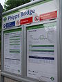 Phipps Bridge tramstop signage.JPG 1,200 × 1,600; 591 KB
-
 Phipps Bridge tramstop southern entrance.JPG 1,600 × 1,200; 532 KB
-
 Lower Addiscombe Road, Croydon - geograph.org.uk - 1347208.jpg 640 × 480; 71 KB
-
 North of Addiscombe tramstop - geograph.org.uk - 1347192.jpg 640 × 480; 83 KB
-
 Wellesley Road, Croydon - geograph.org.uk - 1440941.jpg 3,872 × 2,592; 4.09 MB
-
 Mitcham Junction tram stop - geograph.org.uk - 1537932.jpg 640 × 480; 91 KB
-
 Mitcham Junction stn Tramlink signage.JPG 1,944 × 2,592; 1.17 MB
-
 Cairo New Road, Croydon - geograph.org.uk - 1554531.jpg 640 × 427; 71 KB
-
 Tram in Church Street, Croydon - geograph.org.uk - 1554502.jpg 640 × 427; 98 KB
-
 Morden Road tramstop high westbound2.JPG 2,592 × 1,944; 1.23 MB
-
 Morden Road tramstop signage.JPG 1,944 × 2,592; 1.15 MB
-
 Addington Hills in the Snow - geograph.org.uk - 1624290.jpg 3,872 × 2,592; 6.37 MB
-
 Dashing Through the Snow (crop)- geograph.org.uk - 1624272.jpg 2,140 × 1,632; 1.52 MB
-
 Dashing Through the Snow - geograph.org.uk - 1624272.jpg 3,872 × 2,592; 5.95 MB
-
 Wimbledon stn Tramlink signage.JPG 1,944 × 2,592; 1.15 MB
-

-
 Addington Village tramstop eastern entrance.JPG 1,600 × 1,200; 500 KB
-
 Addington Village tramstop look east.JPG 1,600 × 1,200; 447 KB
-
 Addington Village tramstop look east2.JPG 1,600 × 1,200; 523 KB
-
 Addington Village tramstop look west.JPG 1,600 × 1,200; 474 KB
-
 Addington Village tramstop look west2.JPG 1,600 × 1,200; 529 KB
-
 Addington Village tramstop signage.JPG 1,200 × 1,600; 354 KB
-
 Addington Village tramstop western entrance.JPG 1,600 × 1,200; 492 KB
-
 Addiscombe Tramstop - geograph.org.uk - 1347174.jpg 640 × 480; 76 KB
-
 Addiscombe tramstop look north.JPG 1,600 × 1,200; 467 KB
-
 Addiscombe tramstop look south.JPG 1,600 × 1,200; 628 KB
-
 Addiscombe tramstop northern entrance.JPG 1,600 × 1,200; 515 KB
-
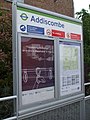 Addiscombe tramstop signage.JPG 1,200 × 1,600; 603 KB
-
 Addiscombe tramstop southern entrance.JPG 1,600 × 1,200; 489 KB
-
 Ampere Way tramstop eastern entrance.JPG 1,600 × 1,200; 463 KB
-
 Ampere Way tramstop look east.JPG 1,600 × 1,200; 466 KB
-
 Ampere Way tramstop look east2.JPG 1,600 × 1,200; 629 KB
-
 Ampere Way tramstop look west.JPG 1,600 × 1,200; 492 KB
-
 Ampere Way tramstop signage.JPG 1,200 × 1,600; 600 KB
-
 Ampere Way tramstop western entrance.JPG 1,600 × 1,200; 496 KB
-
 Arena tram stop eastern entrance.JPG 1,600 × 1,200; 560 KB
-
 Arena tram stop looking north.JPG 1,600 × 1,200; 481 KB
-
 Arena tram stop looking north2.JPG 1,600 × 1,200; 595 KB
-
 Arena tram stop looking south.JPG 1,600 × 1,200; 487 KB
-
 Arena tram stop signage.JPG 1,200 × 1,600; 641 KB
-
 Arena tram stop southeastern entrance.JPG 1,600 × 1,200; 464 KB
-
 Arena tram stop southwest entrance.JPG 1,600 × 1,200; 612 KB
-
 Avenue Road tramstop entrance proper.JPG 2,592 × 1,944; 1.22 MB
-
 Avenue Road tramstop entrance.JPG 2,592 × 1,944; 1.21 MB
-
 Avenue Road tramstop high eastbound.JPG 2,592 × 1,944; 1.24 MB
-
 Avenue Road tramstop high westbound.JPG 2,592 × 1,944; 1.26 MB
-
 Avenue Road tramstop look east.JPG 2,592 × 1,944; 1.21 MB
-
 Avenue Road tramstop look west.JPG 2,592 × 1,944; 1.23 MB
-
 Avenue Road tramstop signage.JPG 1,944 × 2,592; 1.17 MB
-
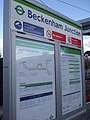
 Beckenham Junction tramstop eastern entrance.JPG 2,592 × 1,944; 1.25 MB
-
 Beckenham Junction tramstop look east.JPG 2,592 × 1,944; 1.21 MB
-
 Beckenham Junction tramstop look east2.JPG 2,592 × 1,944; 1.2 MB
-
 Beckenham Junction tramstop look west with Tram 2543.JPG 2,592 × 1,944; 1.21 MB
-
 Beckenham Junction tramstop looking west.JPG 2,592 × 1,944; 1.22 MB
-
 Beckenham Junction tramstop looking west1.JPG 2,592 × 1,944; 1.22 MB
-
 Beckenham Junction tramstop looking west2.JPG 2,592 × 1,944; 1.22 MB
-
 Beckenham Junction tramstop signage2.JPG 1,944 × 2,592; 1.19 MB
-
 Beckenham Junction tramstop western entrance.JPG 2,592 × 1,944; 1.22 MB
-
 Beckenham Road tram stop - geograph.org.uk - 1633975.jpg 640 × 480; 46 KB
-
 Beckenham Road tramstop entrance.JPG 2,592 × 1,944; 1.19 MB
-
 Beckenham Road tramstop look east.JPG 2,592 × 1,944; 1.21 MB
-
 Beckenham Road tramstop look east2.JPG 2,592 × 1,944; 1.21 MB
-
 Beckenham Road tramstop look west.JPG 2,592 × 1,944; 1.22 MB
-
 Beckenham Road tramstop signage.JPG 1,944 × 2,592; 1.18 MB
-
 Beddington Lane tramstop signage.JPG 1,944 × 2,592; 1.15 MB
-
 Birkbeck stn Tramlink signage.JPG 1,944 × 2,592; 1.15 MB
-
 Blackhorse Lane tramstop entrance DDA.JPG 1,600 × 1,200; 555 KB
-
 Blackhorse Lane tramstop entrance on street.JPG 1,600 × 1,200; 473 KB
-
 Blackhorse Lane tramstop high northbound from road bridge.JPG 1,600 × 1,200; 492 KB
-
 Blackhorse Lane tramstop look north to old junction.JPG 1,600 × 1,200; 512 KB
-
 Blackhorse Lane tramstop look north.JPG 1,600 × 1,200; 497 KB
-
 Blackhorse Lane tramstop look south.JPG 1,600 × 1,200; 492 KB
-
 Blackhorse Lane tramstop signage.JPG 1,200 × 1,600; 609 KB
-
 Church Street tramstop eastern entrance.JPG 1,600 × 1,200; 448 KB
-
 Church Street tramstop look east.JPG 1,600 × 1,200; 441 KB
-
 Church Street tramstop look west to interlaced.JPG 1,600 × 1,200; 531 KB
-
 Church Street tramstop look west.JPG 1,600 × 1,200; 454 KB
-
 Church Street tramstop signage.JPG 1,200 × 1,600; 435 KB
-
 Church Street tramstop western entrance.JPG 1,600 × 1,200; 477 KB
-
 Crown Hill, Croydon - geograph.org.uk - 1747096.jpg 640 × 480; 85 KB
-
 Croydon, Tamworth Road - geograph.org.uk - 1640197.jpg 640 × 480; 63 KB
-
 Dingwall Road Tram Stop, Croydon - geograph.org.uk - 1440828.jpg 640 × 428; 101 KB
-
 Dingwall Road Tram Stop, Croydon - geograph.org.uk - 1440850.jpg 640 × 428; 94 KB
-
 East Croydon Tramlink 2009.JPG 2,592 × 1,944; 1.16 MB
-
 East Croydon tramstop look east.JPG 1,600 × 1,200; 470 KB
-
 East Croydon tramstop look east2.JPG 1,600 × 1,200; 467 KB
-
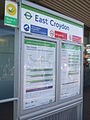 East Croydon tramstop signage.JPG 1,200 × 1,600; 605 KB
-
 Elmers End stn Tramlink signage.JPG 1,944 × 2,592; 886 KB
-
 Engineering Work - geograph.org.uk - 1433551.jpg 3,872 × 2,592; 3.96 MB
-
 Factory Building Near Wandle Park - geograph.org.uk - 1262581.jpg 640 × 480; 71 KB
-
 Fieldway tramstop bus stop look south.JPG 1,600 × 1,200; 333 KB
-
 Fieldway tramstop look north.JPG 1,600 × 1,200; 335 KB
-
 Fieldway tramstop look south.JPG 1,600 × 1,200; 418 KB
-
 Fieldway tramstop northern entrance.JPG 1,600 × 1,200; 406 KB
-
 Fieldway tramstop signage.JPG 1,200 × 1,600; 605 KB
-
 Fieldway tramstop southern entrance.JPG 1,600 × 1,200; 407 KB
-
 George Street tramstop eastern entrance.JPG 1,600 × 1,200; 527 KB
-
 George Street tramstop look east.JPG 1,600 × 1,200; 452 KB
-
 George Street tramstop look west.JPG 1,600 × 1,200; 482 KB
-
 George Street tramstop signage.JPG 1,200 × 1,600; 378 KB
-
 George Street tramstop western entrance.JPG 1,600 × 1,200; 473 KB
-
 George Street, Croydon - geograph.org.uk - 1440908.jpg 640 × 428; 79 KB
-
 George Street, Croydon - geograph.org.uk - 1440918.jpg 640 × 428; 85 KB
-
 George Street, Croydon - geograph.org.uk - 1444033.jpg 428 × 640; 75 KB
-
 George Street, Croydon - geograph.org.uk - 1554947.jpg 427 × 640; 70 KB
-
 Gravel Hill tramstop look east.JPG 1,600 × 1,200; 476 KB
-
 Gravel Hill tramstop look east2.JPG 1,600 × 1,200; 502 KB
-
 Gravel Hill tramstop look west.JPG 1,600 × 1,200; 499 KB
-
 Gravel Hill tramstop northern entrance.JPG 1,600 × 1,200; 486 KB
-
 Gravel Hill tramstop signage.JPG 1,200 × 1,600; 605 KB
-
 Gravel Hill tramstop southern entrance.JPG 1,600 × 1,200; 558 KB
-
 Harrington Road tramstop entrance.JPG 1,600 × 1,200; 559 KB
-
 Harrington Road tramstop look north.JPG 1,600 × 1,200; 486 KB
-
 Harrington Road tramstop look north2.JPG 1,600 × 1,200; 507 KB
-
 Harrington Road tramstop look south.JPG 1,600 × 1,200; 499 KB
-
 Harrington Road tramstop look south2.JPG 1,600 × 1,200; 503 KB
-
 Harrington Road tramstop signage.JPG 1,200 × 1,600; 398 KB
-
 King Henry's Drive tramstop look north.JPG 1,600 × 1,200; 455 KB
-
 King Henry's Drive tramstop look north2.JPG 1,600 × 1,200; 897 KB
-
 King Henry's Drive tramstop look south.JPG 1,600 × 1,200; 517 KB
-
 King Henry's Drive tramstop northern entrance.JPG 1,600 × 1,200; 462 KB
-
 King Henry's Drive tramstop signage.JPG 1,200 × 1,600; 595 KB
-
 King Henry's Drive tramstop southern entrance.JPG 1,600 × 1,200; 507 KB
-
 Lebanon Road tramstop eastbound eastern entrance.JPG 1,600 × 1,200; 461 KB
-
 Lebanon Road tramstop eastbound look east.JPG 1,600 × 1,200; 488 KB
-
 Lebanon Road tramstop eastbound look west.JPG 1,600 × 1,200; 459 KB
-
 Lebanon Road tramstop eastbound western entrance.JPG 1,600 × 1,200; 454 KB
-
 Lebanon Road tramstop look east.JPG 1,600 × 1,200; 362 KB
-
 Lebanon Road tramstop signage.JPG 1,200 × 1,600; 616 KB
-
 Lebanon Road tramstop westbound eastern entrance.JPG 1,600 × 1,200; 480 KB
-
 Lebanon Road tramstop westbound look west.JPG 1,600 × 1,200; 417 KB
-
 Lebanon Road tramstop westbound western entrance.JPG 1,600 × 1,200; 458 KB
-
 Lloyd Park tramstop eastern entrance.JPG 1,600 × 1,200; 486 KB
-
 Lloyd Park tramstop look east.JPG 1,600 × 1,200; 534 KB
-
 Lloyd Park tramstop look west.JPG 1,600 × 1,200; 542 KB
-
 Lloyd Park tramstop signage.JPG 1,200 × 1,600; 438 KB
-
 Lloyd Park tramstop southern entrance.JPG 1,600 × 1,200; 541 KB
-
 Lloyd Park tramstop western entrance.JPG 1,600 × 1,200; 473 KB
-
 Mitcham Tram Stop - geograph.org.uk - 1220268.jpg 640 × 480; 99 KB
-
 Mitcham tramstop signage.JPG 1,944 × 2,592; 1.13 MB
-
 New Addington tramstop looking north.JPG 2,592 × 1,944; 1.22 MB
-
 New Addington tramstop looking north2.JPG 2,592 × 1,944; 1.19 MB
-
 New Addington tramstop looking south.JPG 2,592 × 1,944; 1.21 MB
-
 New Addington tramstop signage.JPG 1,944 × 2,592; 1.16 MB
-
 Reeves Corner tramstop east entrance.JPG 1,600 × 1,200; 454 KB
-
 Reeves Corner tramstop look east.JPG 1,600 × 1,200; 451 KB
_-_geograph.org.uk_-_1241376.jpg)


-_geograph.org.uk_-_1624272.jpg)


.jpg)