Category:2010 aerial photographs of Canada
Jump to navigation
Jump to search
Countries of North America: Canada · Haiti · United States of America‡
‡: partly located in North America
‡: partly located in North America
Media in category "2010 aerial photographs of Canada"
The following 96 files are in this category, out of 96 total.
-

-
 Aerial View of Parry Sound (5432193255).jpg 1,632 × 1,224; 317 KB
-
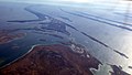
 Aerial view of the South Sasketchewan River -a.jpg 1,871 × 1,243; 437 KB
-
 Aerial view of the Welland Canal.jpg 283 × 378; 70 KB
-
 Aerial-view-of-Montague.jpg 350 × 233; 28 KB
-
 Alberta (4962810132).jpg 1,871 × 1,243; 249 KB
-
 Approche à YUL 24R (vue aérienne de Montréal) (5044838245) (2).jpg 1,871 × 1,243; 340 KB
-
 Approche à YUL 24R (vue aérienne de Montréal) (5044841005) (2).jpg 1,871 × 1,243; 467 KB
-
 Approche à YUL 24R (vue aérienne de Montréal) (5045461846) (2).jpg 1,871 × 1,243; 497 KB
-
 Ariel Shot of Gretna Fall of 2010.jpg 1,024 × 768; 143 KB
-
 Baffin Island, in winter, at 36000 feet -b.jpg 4,011 × 2,674; 888 KB
-
 Baffin Island, in winter, at 36000 feet.jpg 4,191 × 2,794; 1.88 MB
-
 Barrage de Beauharnois (centrale hydroélectrique) (4750356793) (2).jpg 2,805 × 1,863; 401 KB
-
 Beaumont from an Airplane, Alberta.jpg 1,300 × 885; 542 KB
-
 Beaverton from plane.png 417 × 217; 117 KB
-
 Beechey Island 011-AXW 0946.jpg 1,029 × 683; 61 KB
-
 Bell Island (4908421285).jpg 4,272 × 2,848; 2.08 MB
-
 Bourg-Royal.jpg 1,770 × 1,314; 720 KB
-
 Bridge & Dam in Grand-Mère.jpg 972 × 648; 599 KB
-
 Canadian Light Source, on the U of S campus (5675502251).jpg 4,050 × 2,700; 4.62 MB
-
 CCQ3 rwy 16.jpg 3,456 × 2,304; 3.51 MB
-
 Cessna 172 Buttonville Rwy15 Final.jpg 3,648 × 2,736; 3.09 MB
-
 CLS from the air.jpg 4,050 × 2,700; 2.93 MB
-
 Cobequid Bay.jpg 4,000 × 3,000; 4.23 MB
-
 Denman and Hornby Islands.jpg 806 × 576; 165 KB
-
 Departing YQR (5423023473).jpg 1,024 × 765; 379 KB
-
 Dome Mine 2.JPG 1,024 × 768; 327 KB
-
 Ekati mine 640px.jpg 640 × 427; 194 KB
-
 Flight from Winnipeg to Toronto. Over Toronto (460672) (9446910619).jpg 4,238 × 2,386; 2.23 MB
-
 Flying over Baffin Island.jpg 2,048 × 1,536; 1.76 MB
-
 Flying Past Bell Island (4908422345).jpg 4,272 × 2,848; 1.51 MB
-
 Fox Harbour Airport, NS (CFH4).jpg 890 × 720; 255 KB
-
 Hwy 11 North Bay.JPG 874 × 1,091; 242 KB
-
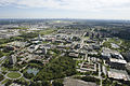
 Innovation Place and CLS.jpg 4,050 × 2,700; 3.8 MB
-
 Jack Garland-North Bay Airport.JPG 944 × 586; 172 KB
-
 JM302928 (5220331057).jpg 1,024 × 768; 129 KB
-
 Kapuskasing Airport 2.JPG 994 × 619; 236 KB
-
 Kazan Falls Nunavut.jpg 4,000 × 3,000; 3.11 MB
-
 Kidd Mine 2.JPG 1,195 × 744; 135 KB
-
 Kindersley, Saskatchewan.jpg 500 × 333; 41 KB
-
 Lake Diefenbaker, Saskatchewan (5028621176) (2) (cropped).jpg 1,871 × 1,099; 291 KB
-
 Lake Diefenbaker, Saskatchewan (5028621176) (2).jpg 1,871 × 1,243; 312 KB
-
 Leduc Apartment Cluster (4705723156).jpg 1,200 × 1,600; 320 KB
-
 Leduc, AB (4705723066).jpg 1,200 × 1,600; 293 KB
-
 Les îles des Trois-Rivières.jpg 850 × 567; 217 KB
-
 Mactaquac, Nouveau-Brunswick, Canada 2010.jpg 3,000 × 2,363; 1.3 MB
-
 Millet, AB (4705080899).jpg 1,600 × 1,200; 295 KB
-
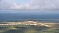
 Mirabel-International.jpg 1,855 × 917; 505 KB
-
 Nain Bay, Tasisuak Lake and Cape Toski in mid-winter Canada - panoramio.jpg 3,264 × 2,448; 1.7 MB
-
 Nickel Rim South mine.JPG 1,389 × 879; 226 KB
-
 NL 2010-05-24 16-41-15 (4649628137).jpg 2,000 × 2,793; 1.23 MB
-
 Oastler Lake.jpg 1,280 × 853; 111 KB
-
 Pano Pingualuit Crater LK.jpg 2,081 × 907; 293 KB
-
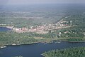
 Photo-aerienne-jonquiere.jpg 864 × 576; 126 KB
-
 Pingualuit Crater LK.jpg 2,048 × 1,536; 385 KB
-
 Point Pelee and the tip of Pelee Island -a.jpg 2,904 × 1,782; 416 KB
-
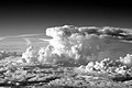 Prarie Storm (4725183668).jpg 4,272 × 2,848; 2.19 MB
-
 Prarie Storms (4803038276).jpg 4,272 × 2,848; 6.73 MB
-
 Red River Floodway from the air.JPG 2,592 × 1,944; 683 KB
-
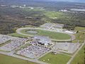 Rideau-Carleton Raceway.JPG 2,048 × 1,536; 1.24 MB
-
 Sanikiluaq peneplain.JPG 2,400 × 1,514; 1.62 MB
-
 Sanikiluaq rocks -d.jpg 2,164 × 1,792; 1.1 MB
-
 Sanikiluaq rocks -e.jpg 2,394 × 1,362; 685 KB
-
 Saskatoon from the air (5675494299).jpg 4,050 × 2,700; 5.35 MB
-
 Sherman Mine areal.jpg 444 × 274; 23 KB
-
 Sherman Mine East Pit from air.jpg 1,232 × 1,840; 915 KB
-
 Sherman Mine South Pit from air 2.jpg 1,840 × 1,232; 651 KB
-
 Sherman Mine South Pit from air.jpg 1,840 × 1,232; 715 KB
-
 Telford Baseball Diamonds (4705723302).jpg 1,600 × 1,200; 235 KB
-
 Telford Park (4705080763).jpg 1,600 × 1,200; 303 KB
-
 Temagami and Sherman Mine from air.jpg 1,840 × 1,232; 477 KB
-
 Temagami townsite from air.jpg 1,840 × 1,232; 730 KB
-
 Thorah island.png 714 × 447; 282 KB
-
 Timmins Airport aerial.JPG 1,536 × 856; 263 KB
-
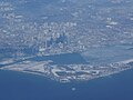
 Toronto Aerial Photo Downtown and CN tower (4994774532).jpg 1,200 × 776; 151 KB
-
 Toronto Downtown Aerial September 2010.jpg 1,024 × 670; 684 KB
-
 Toronto- York University aerial (10056435426).jpg 4,256 × 2,832; 3.09 MB
-
 Toronto-vueaerienne.jpg 4,000 × 3,000; 6.17 MB
-
 UP!!! (4908349180).jpg 3,648 × 2,432; 2.78 MB
-
 Vue aérienne de l'usine Rio-Tinto-Alcan Laterrière.jpg 3,260 × 1,168; 1.65 MB
-
 Vue aérienne de Montréal01.JPG 3,872 × 2,592; 4 MB
-
 Vue aérienne de Montréal02.JPG 3,872 × 2,592; 4.03 MB
-
 Vue aérienne de Montréal03.JPG 3,872 × 2,592; 3.97 MB
-
 Vue aérienne de Montréal04.JPG 3,872 × 2,592; 3.96 MB
-
 Vue aérienne de pylônes.JPG 3,872 × 2,592; 3.93 MB
-
 Vue-Aerienne-WoodstockenBeauce.jpg 4,288 × 2,848; 9.06 MB
-
 VuePartielleParent.JPG 4,000 × 3,000; 3.14 MB
-
 Wetaskiwin, AB (4705723490).jpg 1,600 × 1,200; 385 KB
-
 White Lake.JPG 1,021 × 586; 79 KB
-
 Whitecourt Airport Eastern Perspective.jpg 3,872 × 2,592; 4.3 MB
-
 Whitestone Lake (5142972307).jpg 1,280 × 960; 123 KB
-
 Whitestone Lake (5143577612).jpg 1,280 × 960; 136 KB
-
 Whitestone Lake (5148770193).jpg 1,280 × 960; 152 KB
-
 Whitestone Lake (5149375200).jpg 1,280 × 960; 108 KB
-
 Whitestone Lake (5149375270).jpg 1,280 × 960; 145 KB
-
 YXD Approach.JPG 553 × 415; 81 KB

.jpg)


.jpg)
_(5044838245)_(2).jpg)
_(5044841005)_(2).jpg)
_(5045461846)_(2).jpg)


_(4750356793)_(2).jpg)


.jpg)


.jpg)


.jpg)


_(9446910619).jpg)

.jpg)
.jpg)


.jpg)


_(2)_(cropped).jpg)
_(2).jpg)
.jpg)
.jpg)


.jpg)


.jpg)


.jpg)
.jpg)


.jpg)


.jpg)
.jpg)


.jpg)

.jpg)

.jpg)


.jpg)


.jpg)
.jpg)
.jpg)
.jpg)
.jpg)
