Category:2010s maps of Schleswig-Holstein
Jump to navigation
Jump to search
|
Federal states of Germany: |
Subcategories
This category has the following 7 subcategories, out of 7 total.
Media in category "2010s maps of Schleswig-Holstein"
The following 11 files are in this category, out of 11 total.
-
 Bahnstrecke Husum-St Peter Ording map.png 1,993 × 1,486; 350 KB
-
 Map of the Kiel Canal and Eiderkanal.png 1,814 × 1,407; 3.65 MB
-
 Schleswig-Holstein 2010.png 1,800 × 1,200; 670 KB
-
 Schleswig-Holstein Fehmarn location map.svg 1,455 × 1,198; 388 KB
-
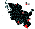
 Schleswig-Holstein Landtagswahlkarte 2009.svg 905 × 748; 139 KB
-
 Schleswig-Holstein Landtagswahlkarte 2012.svg 512 × 426; 150 KB
-
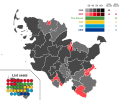
 Schleswig-Holstein Landtagswahlkarte 2017.svg 905 × 748; 1.61 MB
-
 Schleswig-Holstein State Election 2012.svg 512 × 427; 435 KB
-
 Schleswig-Holstein State Election 2017.svg 512 × 427; 1.39 MB
-
 Sild Øbane.png 1,000 × 1,369; 219 KB
-
 Umgebung Schleswig.jpg 520 × 464; 53 KB


