Category:2012 U.S. presidential election maps, Republican primary, county subdivisions
Jump to navigation
Jump to search
Français : Cartes des primaires du parti républicain pour l'élection présidentielle de 2012 aux États-Unis, subdivisées par comtés.
Media in category "2012 U.S. presidential election maps, Republican primary, county subdivisions"
The following 8 files are in this category, out of 8 total.
-
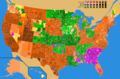
 2012 County Map Percentages.png 1,498 × 980; 140 KB
-

-
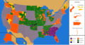
 2012 Republican Primaries.png 1,513 × 983; 191 KB
-
-

-
 Republican Party presidential primaries results by county, 2012 (corrected).png 1,866 × 988; 149 KB
-
 Republican Party presidential primaries results by county, 2012.png 1,513 × 983; 160 KB
-
 Republican Party presidential primaries results by county, 2012.svg 1,304 × 828; 1.58 MB


,_2012.png)
-2.png)
.png)

