Category:2013 in Easingwold
Jump to navigation
Jump to search
Media in category "2013 in Easingwold"
The following 23 files are in this category, out of 23 total.
-
 Church Avenue, Easingwold - geograph.org.uk - 3354652.jpg 1,024 × 768; 485 KB
-
 Church of St John the Baptist and All Saints - geograph.org.uk - 3354659.jpg 1,024 × 768; 337 KB
-
 Church tower in winter sunshine - geograph.org.uk - 3354696.jpg 768 × 1,024; 386 KB
-
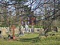 Churchyard, Easingwold - geograph.org.uk - 3354668.jpg 1,024 × 768; 576 KB
-
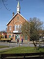
 Easingwold Library - geograph.org.uk - 3354882.jpg 768 × 1,024; 386 KB
-
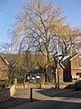
 End of Long Street - geograph.org.uk - 3355027.jpg 1,024 × 716; 233 KB
-
 Fine buildings along Spring Street - geograph.org.uk - 3355105.jpg 1,024 × 768; 244 KB
-
 Former town hall, Easingwold (geograph 3354992).jpg 768 × 1,024; 301 KB
-
 Former town hall, Easingwold (geograph 3355051).jpg 1,024 × 768; 283 KB
-
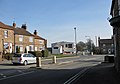
 Junction of Church Hill and Spring Street - geograph.org.uk - 3355112.jpg 1,024 × 768; 336 KB
-
 K6 phonebox, Uppleby - geograph.org.uk - 3355127.jpg 1,024 × 768; 329 KB
-
 Little Lane - geograph.org.uk - 3355039.jpg 1,024 × 768; 337 KB
-
 Little Lane, Easingwold - geograph.org.uk - 3355037.jpg 1,024 × 759; 312 KB
-
 Longley House, Easingwold - geograph.org.uk - 3354644.jpg 1,024 × 768; 282 KB
-
 Market Cross, Easingwold - geograph.org.uk - 3354974.jpg 1,024 × 768; 301 KB
-
 New Inn. Easingwold - geograph.org.uk - 3354647.jpg 1,024 × 736; 264 KB
-
 Sash windows, Uppleby - geograph.org.uk - 3355120.jpg 1,024 × 768; 413 KB
-
 St Monica's Hospital, Easingwold - geograph.org.uk - 3355024.jpg 1,024 × 768; 504 KB
-
 Tanpit Lane, Easingwold - geograph.org.uk - 3354877.jpg 770 × 1,024; 346 KB
-
 The Angel - geograph.org.uk - 3355054.jpg 1,024 × 768; 334 KB
-
 The Commercial, Easingwold - geograph.org.uk - 3354961.jpg 1,024 × 768; 255 KB
-
 The Horseshoe pub sign - geograph.org.uk - 3355032.jpg 838 × 1,024; 255 KB
-
 Uppleby - geograph.org.uk - 3355115.jpg 1,024 × 768; 378 KB


.jpg)
.jpg)


