Category:2014 Atlantic hurricane season track maps
Jump to navigation
Jump to search
Media in category "2014 Atlantic hurricane season track maps"
The following 21 files are in this category, out of 21 total.
-
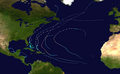
 2014 Atlantic hurricane season summary map.png 4,000 × 2,476; 6.1 MB
-
 2014 Atlantic hurricane season summary.png 4,000 × 2,476; 4.87 MB
-
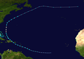
 Arthur 2014 path.png 2,700 × 2,567; 5.74 MB
-
 Arthur 2014 track.png 2,700 × 2,568; 4.69 MB
-
 Bertha 2014 path.png 2,700 × 1,904; 1.96 MB
-
 Bertha 2014 track.png 2,700 × 1,905; 1.54 MB
-
 Cristobal 2014 path.png 2,700 × 2,283; 2.9 MB
-
 Cristobal 2014 track.png 2,700 × 2,283; 2.19 MB
-
 Edouard 2014 path.png 2,700 × 2,172; 382 KB
-
 Edouard 2014 track.png 2,700 × 2,172; 252 KB
-
 Fay 2014 path.png 2,700 × 1,668; 1.44 MB
-
 Fay 2014 track.png 2,700 × 1,669; 1.02 MB
-
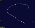
 Gonzalo 2014 track.png 2,700 × 2,683; 1.39 MB
-
 Gonzalo 2014 path.png 2,700 × 2,683; 1.91 MB
-
 02-L 2014 path.png 2,700 × 1,668; 1.36 MB
-
 02-L 2014 track.png 2,700 × 1,669; 983 KB
-
 Dolly 2014 path.png 2,700 × 1,668; 4.16 MB
-
 Dolly 2014 track.png 2,700 × 1,669; 3.1 MB
-
 Hanna 2014 path.png 2,700 × 1,668; 3.62 MB
-
 Hanna 2014 track.png 2,700 × 1,669; 2.67 MB
-
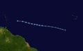
 Trudy and Hanna 2014 track.png 2,700 × 1,669; 3.08 MB


