Category:2015 at the University of York
Jump to navigation
Jump to search
Media in category "2015 at the University of York"
The following 200 files are in this category, out of 300 total.
(previous page) (next page)-
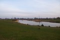
 Across the lake to Derwent - geograph.org.uk - 4566571.jpg 640 × 420; 96 KB
-
 Across the lake to Vanbrugh - geograph.org.uk - 4795570.jpg 640 × 427; 81 KB
-
 Across to Vanbrugh College - geograph.org.uk - 4675721.jpg 640 × 427; 69 KB
-
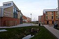
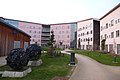
 Alcuin accommodation blocks - geograph.org.uk - 4795155.jpg 640 × 427; 93 KB
-
 Alcuin car park - geograph.org.uk - 4795156.jpg 640 × 427; 94 KB
-
 Alcuin J block - geograph.org.uk - 4795147.jpg 640 × 427; 93 KB
-
 All weather pitch - geograph.org.uk - 4675755.jpg 640 × 427; 82 KB
-
 Athletics Track - geograph.org.uk - 4525852.jpg 640 × 480; 89 KB
-
 Athletics track - geograph.org.uk - 4704803.jpg 640 × 427; 80 KB
-
 Barbara Scott accommodation - York University - geograph.org.uk - 4730780.jpg 1,024 × 683; 168 KB
-
 Barbara Scott Court Block F - geograph.org.uk - 4755766.jpg 427 × 640; 80 KB
-
 Basketball court - geograph.org.uk - 4394991.jpg 640 × 428; 69 KB
-
 Berrick Saul and Central Hall - geograph.org.uk - 4770389.jpg 640 × 427; 119 KB
-
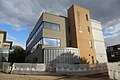
 Berrick Saul building - geograph.org.uk - 4676424.jpg 640 × 427; 89 KB
-
 Between James K and J blocks - geograph.org.uk - 4675739.jpg 427 × 640; 81 KB
-
 Biology A block labs - geograph.org.uk - 4372293.jpg 640 × 428; 63 KB
-
 Biology bike shed - geograph.org.uk - 4372291.jpg 640 × 428; 79 KB
-
 Biology greenhouses - geograph.org.uk - 4500753.jpg 640 × 480; 157 KB
-
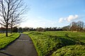
 Biology lakeside path - geograph.org.uk - 4704771.jpg 640 × 467; 190 KB
-
 Biology Phase 2 - geograph.org.uk - 4715738.jpg 640 × 427; 117 KB
-
 Biology Phase 2 Construction - geograph.org.uk - 4660682.jpg 640 × 480; 79 KB
-
 Biology Phase II - geograph.org.uk - 4795427.jpg 640 × 427; 121 KB
-
 Biology Q Block - geograph.org.uk - 4795433.jpg 640 × 427; 117 KB
-
 Biology Q Block - geograph.org.uk - 4795434.jpg 640 × 427; 113 KB
-
 Bleachfields - geograph.org.uk - 4754016.jpg 640 × 427; 147 KB
-
 Block H - geograph.org.uk - 4387237.jpg 640 × 428; 72 KB
-
 Block H ^ D - geograph.org.uk - 4387222.jpg 640 × 428; 79 KB
-
 Blocks D, H ^ G - geograph.org.uk - 4387247.jpg 640 × 428; 77 KB
-
 Central Hall - geograph.org.uk - 4769424.jpg 427 × 640; 82 KB
-
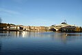
 Central Hall and bridge - geograph.org.uk - 4714586.jpg 640 × 427; 79 KB
-
 Central Hall and Bridge - geograph.org.uk - 4717952.jpg 640 × 427; 71 KB
-
 Central Hall and fountain - geograph.org.uk - 4372295.jpg 640 × 428; 66 KB
-
 Central Hall and Physics-Electronics - geograph.org.uk - 4704778.jpg 640 × 427; 62 KB
-
 Central Hall and Vanbrugh Paradise - geograph.org.uk - 4675717.jpg 640 × 427; 77 KB
-
 Central Hall and Vanbrugh Paradise - geograph.org.uk - 4717944.jpg 640 × 427; 69 KB
-
 Central Hall and Vanbrugh Paradise - geograph.org.uk - 4770281.jpg 640 × 427; 90 KB
-
 Central Hall at dusk - geograph.org.uk - 4771356.jpg 640 × 427; 77 KB
-
 Central Hall Balcony - geograph.org.uk - 4796097.jpg 640 × 427; 98 KB
-
 Central Hall Bridge - geograph.org.uk - 4372303.jpg 640 × 428; 85 KB
-
 Central Hall Bridge - geograph.org.uk - 4714582.jpg 640 × 427; 80 KB
-
 Central Hall Bridge at night - geograph.org.uk - 4714578.jpg 640 × 311; 53 KB
-

-
 Cherry trees - geograph.org.uk - 4676574.jpg 640 × 427; 115 KB
-
 Clearing the site - geograph.org.uk - 4676526.jpg 640 × 427; 138 KB
-
 Constantine A Block - geograph.org.uk - 4387250.jpg 640 × 428; 67 KB
-
 Constantine B Block - geograph.org.uk - 4387252.jpg 640 × 428; 70 KB
-
 Constantine B, F and A blocks - geograph.org.uk - 4394985.jpg 640 × 428; 70 KB
-
 Constantine Blocks B, F and A - geograph.org.uk - 4394994.jpg 640 × 428; 77 KB
-
 Constantine C block - geograph.org.uk - 4394977.jpg 640 × 428; 78 KB
-
 Constantine College - geograph.org.uk - 4387234.jpg 640 × 428; 67 KB
-
 Constantine College nucleus - geograph.org.uk - 4394970.jpg 640 × 428; 76 KB
-
 Constantine Nucleus - geograph.org.uk - 4387242.jpg 640 × 428; 73 KB
-
-

-

-
 Constructing the Spring Lane building - geograph.org.uk - 4770299.jpg 640 × 427; 131 KB
-

-
 Construction on Heslington East - geograph.org.uk - 4680899.jpg 640 × 427; 67 KB
-
 Covered reservoir - geograph.org.uk - 4795180.jpg 640 × 427; 124 KB
-
 Crossing paths - geograph.org.uk - 4770401.jpg 640 × 427; 98 KB
-
 Cycle path from Siwards How - geograph.org.uk - 4795390.jpg 640 × 427; 133 KB
-
 Cycle path passing under University Road - geograph.org.uk - 4795409.jpg 427 × 640; 160 KB
-
 Dalham Farm - geograph.org.uk - 4704811.jpg 640 × 427; 90 KB
-
 Department of Chemistry - geograph.org.uk - 4394900.jpg 623 × 640; 171 KB
-
 Derwent and Heslington Lawns - geograph.org.uk - 4675706.jpg 640 × 427; 95 KB
-
 Derwent C and D blocks - geograph.org.uk - 4796906.jpg 640 × 427; 127 KB
-
 Derwent College L Block - geograph.org.uk - 4704828.jpg 640 × 427; 103 KB
-
 Derwent D block - geograph.org.uk - 4796909.jpg 640 × 427; 109 KB
-
 Derwent fountains and dining hall - geograph.org.uk - 4718211.jpg 640 × 427; 70 KB
-
 Derwent K Block bridge - geograph.org.uk - 4454272.jpg 480 × 640; 153 KB
-
 Derwent L Block - geograph.org.uk - 4372312.jpg 640 × 428; 55 KB
-
 Derwent Lawns - geograph.org.uk - 4675701.jpg 640 × 427; 117 KB
-
 Derwent P Block - geograph.org.uk - 4676549.jpg 640 × 427; 87 KB
-
 Dining Room terrace - geograph.org.uk - 4770277.jpg 640 × 427; 89 KB
-
 District heating pipes - geograph.org.uk - 4705057.jpg 559 × 640; 163 KB
-
 Donald Barron accommodation, York University - geograph.org.uk - 4730785.jpg 1,024 × 683; 171 KB
-

-
 Donald Barron Court block D - geograph.org.uk - 4795419.jpg 640 × 427; 116 KB
-
 Drama Barn - geograph.org.uk - 4769270.jpg 640 × 427; 120 KB
-
 Duck sailing to Wentworth - geograph.org.uk - 4675730.jpg 640 × 427; 96 KB
-
 East lake - geograph.org.uk - 4395387.jpg 640 × 428; 62 KB
-
 Edge of the lake near Wentworth - geograph.org.uk - 4675761.jpg 640 × 427; 135 KB
-
 Edge of Vanbrugh Paradise - geograph.org.uk - 4769403.jpg 640 × 427; 83 KB
-
 Electronics P and Z blocks - geograph.org.uk - 4771349.jpg 640 × 427; 102 KB
-
 End of the road - geograph.org.uk - 4387230.jpg 640 × 428; 59 KB
-
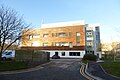
 Environment Building - geograph.org.uk - 4795518.jpg 640 × 427; 118 KB
-
 Environment Building and James Bridge - geograph.org.uk - 4795481.jpg 427 × 640; 110 KB
-
 Environment building and lakeside - geograph.org.uk - 4795509.jpg 427 × 640; 99 KB
-

-
 Environment Building construction - geograph.org.uk - 4676262.jpg 640 × 427; 84 KB
-

-

-
 Estates Greenhouses - geograph.org.uk - 4675693.jpg 640 × 427; 106 KB
-
 Fireworks from Vanbrugh Paradise - geograph.org.uk - 4717936.jpg 640 × 427; 64 KB
-
 Fireworks over Vanbrugh - geograph.org.uk - 4717941.jpg 427 × 640; 83 KB
-
 Flood wall works - geograph.org.uk - 4795491.jpg 427 × 640; 134 KB
-
 Flood wall works at Wentworth - geograph.org.uk - 4795525.jpg 640 × 427; 154 KB
-
 Football field - geograph.org.uk - 4771334.jpg 640 × 427; 69 KB
-
 Fountain and Vanbrugh Bridge - geograph.org.uk - 4372302.jpg 640 × 428; 64 KB
-
 Fountain and Vanbrugh Bridge - geograph.org.uk - 4372307.jpg 640 × 428; 61 KB
-
 Front of Derwent College - geograph.org.uk - 4796912.jpg 640 × 427; 103 KB
-
 Garages and building site - geograph.org.uk - 4676571.jpg 640 × 427; 116 KB
-
 Garden in the Berrick Saul building - geograph.org.uk - 4676430.jpg 427 × 640; 114 KB
-
 Gatepost on Derwent Lawns - geograph.org.uk - 4796116.jpg 640 × 427; 120 KB
-
 Geese on the lake - geograph.org.uk - 4395392.jpg 640 × 428; 72 KB
-
 Goodricke College Nucleus - geograph.org.uk - 4395366.jpg 640 × 428; 95 KB
-

-
 Gordon and Francesca Horsfield Court - geograph.org.uk - 4395213.jpg 640 × 428; 84 KB
-
 Greg's Place - geograph.org.uk - 4769430.jpg 640 × 427; 98 KB
-
 Grimston House - geograph.org.uk - 4769323.jpg 640 × 427; 84 KB
-
 Grounds Department - geograph.org.uk - 4771343.jpg 640 × 427; 83 KB
-
 Halifax College Laundrette - geograph.org.uk - 4770459.jpg 640 × 427; 101 KB
-
 Halifax College McHugh Court - geograph.org.uk - 4770421.jpg 640 × 427; 94 KB
-
 Harewood Way - geograph.org.uk - 4770315.jpg 640 × 427; 136 KB
-
 Heslington East Buildings - geograph.org.uk - 4395378.jpg 640 × 428; 77 KB
-
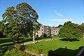
 Heslington Hall - geograph.org.uk - 4730793.jpg 1,024 × 683; 156 KB
-
 Heslington Hall and Lawns - geograph.org.uk - 4675685.jpg 640 × 427; 94 KB
-
 Heslington Hall over the lake - geograph.org.uk - 4675713.jpg 427 × 640; 82 KB
-
 Heslington Hall, near York - geograph.org.uk - 4700336.jpg 640 × 474; 440 KB
-
 Heslington Lake - geograph.org.uk - 4525848.jpg 640 × 360; 93 KB
-
 Hickleton Court - geograph.org.uk - 4771328.jpg 640 × 427; 93 KB
-
 Holmefield Community Centre - geograph.org.uk - 4770416.jpg 640 × 427; 101 KB
-
 Ingram Court - geograph.org.uk - 4770591.jpg 640 × 427; 86 KB
-
 James Bridge and Environment - geograph.org.uk - 4795515.jpg 640 × 427; 116 KB
-
 James Bridge and James College N block - geograph.org.uk - 4795486.jpg 640 × 427; 126 KB
-
 James College blocks P and Q - geograph.org.uk - 4771351.jpg 640 × 427; 65 KB
-
 James College Lakehouse - geograph.org.uk - 4795539.jpg 640 × 427; 123 KB
-
 James College N Block - geograph.org.uk - 4795543.jpg 640 × 427; 119 KB
-
 James N block lakeside - geograph.org.uk - 4795553.jpg 427 × 640; 138 KB
-
 James Nucleus and Rail Sculpture - geograph.org.uk - 4704786.jpg 640 × 427; 92 KB
-
 James P and Electronics Z - geograph.org.uk - 4771353.jpg 640 × 427; 90 KB
-
 James walkways - geograph.org.uk - 4372296.jpg 640 × 428; 70 KB
-
 Janet Baker Court - geograph.org.uk - 4395369.jpg 640 × 428; 89 KB
-
 Janet Baker Court and nucleus - geograph.org.uk - 4395362.jpg 640 × 428; 89 KB
-
 JJ's and Younger Court - geograph.org.uk - 4770592.jpg 640 × 427; 99 KB
-
 JJs - geograph.org.uk - 4771320.jpg 640 × 427; 84 KB
-
 John West Taylor court - geograph.org.uk - 4395204.jpg 640 × 428; 90 KB
-
 K block through the trees - geograph.org.uk - 4675714.jpg 640 × 427; 110 KB
-
 King's Manor, York 1.jpg 3,456 × 5,184; 5.2 MB
-
 King's Manor, York 2.jpg 5,184 × 3,456; 4.76 MB
-
 King's Manor, York 3.jpg 5,184 × 3,456; 5.01 MB
-
 King's Manor, York 4.jpg 3,456 × 5,184; 4.45 MB
-

-
 Lake and Vanbrugh from Central Hall - geograph.org.uk - 4796102.jpg 640 × 427; 98 KB
-
 Lake and Vanbrugh over the water - geograph.org.uk - 4498824.jpg 640 × 480; 67 KB
-
 Lake from behind James College - geograph.org.uk - 4675737.jpg 640 × 427; 151 KB
-
 Lake in front of Wentworth D block - geograph.org.uk - 4675887.jpg 640 × 427; 72 KB
-
 Lake near Central Hall - geograph.org.uk - 4675716.jpg 640 × 427; 123 KB
-
 Lake near Derwent - geograph.org.uk - 4523952.jpg 640 × 480; 111 KB
-
 Lake near Derwent - geograph.org.uk - 4675709.jpg 640 × 427; 96 KB
-
 Lake near Vanbrugh - geograph.org.uk - 4704781.jpg 640 × 427; 59 KB
-
 Lake on Heslington East - geograph.org.uk - 4395389.jpg 640 × 428; 69 KB
-
 Lake path and Environment building - geograph.org.uk - 4676257.jpg 427 × 640; 144 KB
-
 Langwith College - geograph.org.uk - 4395239.jpg 640 × 428; 84 KB
-
 Langwith college York new center building.jpg 3,120 × 4,160; 4.17 MB
-
 Langwith from Constantine - geograph.org.uk - 4394983.jpg 640 × 428; 64 KB
-
 Langwith nucleus and accommodation - geograph.org.uk - 4395221.jpg 640 × 428; 81 KB
-
 Library Bridge - geograph.org.uk - 4702473.jpg 640 × 427; 94 KB
-
 Lights besides the lake - geograph.org.uk - 4717948.jpg 427 × 640; 81 KB
-
 Liquid nitrogen delivery - geograph.org.uk - 4736258.jpg 640 × 480; 93 KB
-
 Looking down from Central Hall - geograph.org.uk - 4796103.jpg 640 × 427; 99 KB
-
 Love York - geograph.org.uk - 4717987.jpg 640 × 524; 110 KB
-
 Market Square - geograph.org.uk - 4714743.jpg 640 × 427; 86 KB
-

-
 Music Department - geograph.org.uk - 4769277.jpg 640 × 427; 87 KB
-
 Music Research Centre - geograph.org.uk - 4769263.jpg 640 × 427; 104 KB
-
 New athletics track - geograph.org.uk - 4704800.jpg 640 × 427; 66 KB
-
 New Environment building - geograph.org.uk - 4676283.jpg 640 × 427; 123 KB
-
 New Environment Building - geograph.org.uk - 4795443.jpg 640 × 427; 109 KB
-
-
 New Flood Wall - geograph.org.uk - 4795581.jpg 640 × 427; 98 KB
-
 New Vanbrugh - geograph.org.uk - 4769132.jpg 640 × 427; 69 KB
-
 New Vanbrugh Blocks C and D - geograph.org.uk - 4756316.jpg 640 × 427; 97 KB
-
 Nisa Local - geograph.org.uk - 4771315.jpg 640 × 427; 90 KB
-
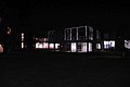
 North Car Park at night - geograph.org.uk - 4714753.jpg 640 × 427; 72 KB
-
 Outside Biology - geograph.org.uk - 4449891.jpg 640 × 480; 191 KB
-
 Part of the music department - geograph.org.uk - 4769252.jpg 640 × 427; 108 KB
-
 Partially assembled steelwork - geograph.org.uk - 4770307.jpg 640 × 427; 110 KB
-
 Path around the sports pitches - geograph.org.uk - 4704791.jpg 640 × 427; 76 KB
-
 Path behind Alcuin - geograph.org.uk - 4795175.jpg 640 × 427; 109 KB
-
 Path behind Market Square - geograph.org.uk - 4769390.jpg 640 × 427; 107 KB
-
 Path between James College and the Lake - geograph.org.uk - 4675733.jpg 427 × 640; 163 KB
-
 Path crossing 22 acres - geograph.org.uk - 4771330.jpg 640 × 427; 83 KB
-
 Path near Derwent K block - geograph.org.uk - 4736271.jpg 640 × 374; 129 KB
-
 Path next to Heslington Lane - geograph.org.uk - 4704794.jpg 640 × 427; 91 KB
-
 Path next to More House - geograph.org.uk - 4770407.jpg 640 × 427; 128 KB
-
 Path past music - geograph.org.uk - 4769317.jpg 640 × 427; 114 KB
-
 Path to Biology - geograph.org.uk - 4795414.jpg 640 × 427; 153 KB
-

-
 Path to Spring Lane - geograph.org.uk - 4449909.jpg 480 × 640; 186 KB
-
 Path to the footpath - geograph.org.uk - 4770471.jpg 427 × 640; 119 KB
-
 Path to Wentworth Nucleus - geograph.org.uk - 4676235.jpg 427 × 640; 123 KB
-
 Path under Vanbrugh Dining Hall - geograph.org.uk - 4769428.jpg 427 × 640; 90 KB
-
 Path up Siwards How - geograph.org.uk - 4795404.jpg 640 × 427; 126 KB
-
 Paths on 22 acres - geograph.org.uk - 4771332.jpg 640 × 427; 70 KB
-
 Phase II Construction - geograph.org.uk - 4795428.jpg 640 × 427; 135 KB
-
 Quiet Place gardens - geograph.org.uk - 4675702.jpg 427 × 640; 127 KB
-
 Rear of the Roger Kirk Centre - geograph.org.uk - 4795541.jpg 640 × 427; 128 KB
-
 Rebuilding Vanbrugh Paradise - geograph.org.uk - 4676420.jpg 640 × 427; 84 KB
-
 Rebuilt Vanbrugh Paradise - geograph.org.uk - 4769393.jpg 640 × 427; 79 KB


