Category:2016 on Nottingham Express Transit
Jump to navigation
Jump to search
Media in category "2016 on Nottingham Express Transit"
The following 55 files are in this category, out of 55 total.
-
 Clifton South Tram Stop (geograph 4791203).jpg 1,600 × 1,200; 257 KB
-
 Holy Trinity Tram Stop (geograph 4791205).jpg 1,600 × 1,200; 266 KB
-
 The Meadows, Meadows Way NET 9948.JPG 3,264 × 2,448; 3.78 MB
-
 The Meadows, Meadows Way NET 9949.JPG 3,264 × 2,448; 3.38 MB
-
 The Meadows, Queens Walk 9983.JPG 3,264 × 2,448; 4.28 MB
-
 The Meadows, Queens Walk 9984.JPG 3,264 × 2,448; 4.14 MB
-
 The Meadows, Queens Walk 9985.JPG 3,264 × 2,448; 4.25 MB
-
 The Meadows, departing Queens Walk NET 9986.JPG 3,264 × 2,448; 3.65 MB
-
 The Meadows, Queens Walk NET 9992.JPG 3,264 × 2,448; 3.13 MB
-
 The Meadows, Queens Walk NET 9995.JPG 3,264 × 2,448; 4 MB
-
 The Meadows, Queens Walk NET 9996.JPG 3,264 × 2,448; 3.26 MB
-
 The Meadows, Queens Walk 9998.JPG 3,264 × 2,448; 3.66 MB
-
 The Meadows, Queens Walk NET 9999.JPG 3,264 × 2,448; 3.75 MB
-
 The Meadows, Queens Walk NET 0001.JPG 3,264 × 2,448; 3.93 MB
-
 The Meadows, Queens Walk NET 0002.JPG 3,264 × 2,448; 3.84 MB
-
 Clifton South tram stop 2016-05-01 11.28.04.jpg 3,264 × 1,836; 1.86 MB
-
 Clifton South tram stop 2016-05-01 11.37.43.jpg 3,264 × 1,836; 1.79 MB
-
 Wilford Lane tram stop 2016-05-01 11.56.39.jpg 3,264 × 1,836; 1.99 MB
-
 Wilford Lane tram stop 2016-05-01 11.57.14.jpg 3,264 × 1,836; 1.86 MB
-
 Wilford Lane tram stop 2016-05-01 11.58.06.jpg 3,264 × 1,836; 1.86 MB
-
 Wilford Lane tram stop 2016-05-01 12.00.22.jpg 3,264 × 1,836; 2.06 MB
-
 Toton Lane 2016-05-01 13.33.26.jpg 3,264 × 1,836; 1.71 MB
-
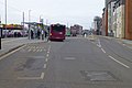
 Beeston transport interchange 2016-05-01 13.47.54.jpg 3,264 × 1,836; 1.32 MB
-
 Beeston transport interchange 2016-05-01 13.51.00.jpg 3,264 × 1,836; 2.02 MB
-
 Beeston transport interchange 2016-05-01 13.51.34.jpg 3,264 × 1,836; 1.49 MB
-
 University Boulevard tram stop 2016-05-01 14.21.54.jpg 3,264 × 1,836; 2.54 MB
-
 University Boulevard tram stop 2016-05-01 14.23.17.jpg 3,264 × 1,836; 2.44 MB
-
 Queen's Medical Centre NET stop 01.jpg 3,264 × 1,836; 2.05 MB
-
 Queen's Medical Centre NET stop 02.jpg 3,264 × 1,836; 1.87 MB
-
 Queen's Medical Centre NET stop 03.jpg 3,264 × 1,836; 1.46 MB
-
 Queen's Medical Centre NET stop 04.jpg 3,264 × 1,836; 1.59 MB
-
 Queen's Medical Centre NET stop 05.jpg 3,264 × 1,836; 2 MB
-
 Hucknall station 2016-05-01 16.43.18.jpg 3,264 × 1,836; 1.92 MB
-
 Hucknall station 2016-05-01 16.43.36.jpg 3,264 × 1,836; 2.21 MB
-
 Bulwell station 2016-05-01 17.09.13.jpg 3,264 × 1,836; 2.62 MB
-
 Bulwell station 2016-05-01 17.10.17.jpg 3,264 × 1,836; 2.3 MB
-
 Bulwell station 2016-05-01 17.12.12.jpg 3,264 × 1,836; 2.61 MB
-
 Bulwell station 2016-05-01 17.12.20.jpg 3,264 × 1,836; 2.66 MB
-
 Bulwell station 2016-05-01 17.12.37.jpg 3,264 × 1,836; 2.19 MB
-
 A Toton tram in Cheapside - geograph.org.uk - 4937002.jpg 768 × 1,024; 1.02 MB
-
 Passing the Council House (geograph 5501822).jpg 800 × 800; 800 KB
-
 At Royal Centre tram stop - geograph.org.uk - 4956147.jpg 819 × 1,024; 1.17 MB
-
 Clifton Centre tram stop (geograph 4956487).jpg 1,024 × 732; 991 KB
-
 Clifton- Holy Trinity tram stop (geograph 4956513).jpg 1,024 × 1,024; 1.17 MB
-
 Clifton- Rivergreen tram stop (geograph 4956478).jpg 1,024 × 732; 941 KB
-
 North from Wilford Lane - geograph.org.uk - 4974751.jpg 819 × 1,024; 1.04 MB
-
 Passing trams at Wilford Lane - geograph.org.uk - 4974770.jpg 1,024 × 732; 857 KB
-
 At Cinderhill tram stop - geograph.org.uk - 5685179.jpg 819 × 1,024; 1.18 MB
-
 Tram climbing from Arkwright Street - geograph.org.uk - 4993315.jpg 819 × 1,024; 916 KB
-
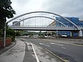 Bridge over Clifton Boulevard (A52) (geograph 5031738).jpg 640 × 480; 66 KB
-

-
 Forest tram stop (Geograph-5035569-by-John-Sutton).jpg 1,024 × 768; 1.03 MB
-
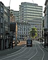 Poultry and Cheapside - geograph.org.uk - 5044466.jpg 819 × 1,024; 1.05 MB
-
 University Boulevard Tram Stop (geograph 5094050).jpg 4,873 × 3,249; 3.91 MB
-
 Is this still Styring Street? (geograph 5230570).jpg 1,280 × 853; 248 KB
.jpg)
.jpg)


.jpg)

.jpg)
.jpg)
.jpg)


_(geograph_5031738).jpg)

.jpg)

.jpg)
.jpg)