Category:2017 Georgia (U.S. state) photos by Mjrmtg taken with Canon EOS 700D
Jump to navigation
Jump to search
Media in category "2017 Georgia (U.S. state) photos by Mjrmtg taken with Canon EOS 700D"
The following 186 files are in this category, out of 186 total.
-
 Abandoned gas station, Chula Brookfield Rd, Tift County.jpg 5,184 × 3,456; 6.13 MB
-
 Americus city limit US19SB.jpg 5,184 × 3,456; 8.32 MB
-
 Applebee's, Tanger Outlets Savannah.jpg 5,184 × 3,456; 6.98 MB
-
 Arlington Depot.jpg 5,184 × 3,456; 10 MB
-
 Arlington Post Office, Georgia.jpg 5,184 × 3,456; 8.31 MB
-
 Boykin limit, US27NB.jpg 5,184 × 3,456; 7.03 MB
-
 Casper Pecan Company.jpg 5,184 × 3,456; 9.75 MB
-
 Chess tables, Tanger Outlets Savannah.jpg 5,184 × 3,456; 7.17 MB
-
 Chili's, Pooler.jpg 5,184 × 3,456; 7.94 MB
-
 Colquitt city limit, US27NB.jpg 5,184 × 3,456; 7.3 MB
-
 Ellaville city limit US19SB.jpg 5,184 × 3,456; 7.66 MB
-
 Family Dollar, Screven.jpg 5,184 × 3,456; 6.77 MB
-
 Former Ben Hill County Elementary School.jpg 5,184 × 3,456; 5.66 MB
-
 Fort Valley city limit US341SB.jpg 5,184 × 3,456; 7.58 MB
-
 GA128 NB end Roberta.jpg 5,184 × 3,456; 7.46 MB
-
 GA253SpurNB end.jpg 5,184 × 3,456; 7.16 MB
-
 GA33 Conn WB end, Crisp County.jpg 5,184 × 3,456; 8.55 MB
-
 GA33 NB end, Crisp County.jpg 5,184 × 3,456; 9.81 MB
-
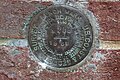 Geodetic Marker M268, Jesup City Hall.jpg 5,184 × 3,456; 9.54 MB
-
 Georgia Forestry Commission Tower, Waycross Ware County Airport.jpg 5,184 × 3,456; 7.45 MB
-
 Georgia Forestry Commission, Decatur County.jpg 5,184 × 3,456; 8.6 MB
-
 Georgia I16eb End.jpg 5,184 × 3,456; 6.92 MB
-
 Georgia I16eb Exit 160 1 mile.jpg 5,184 × 3,456; 4.73 MB
-
 Georgia I16eb Exit 160.jpg 5,184 × 3,456; 5.05 MB
-
 Georgia I16eb Exit 162 1 mile.jpg 5,184 × 3,456; 4.81 MB
-
 Georgia I16eb Exit 162.jpg 5,184 × 3,456; 5 MB
-
 Georgia I16eb Exit 164A-B 2 miles.jpg 5,184 × 3,456; 4.34 MB
-
 Georgia I16eb Exit 164A.jpg 5,184 × 3,456; 5.12 MB
-
 Georgia I16eb Exit 164B.jpg 5,184 × 3,456; 4.93 MB
-
 Georgia I16eb Exit 165 .5 mile.jpg 5,184 × 3,456; 4.93 MB
-
 Georgia I16eb Exit 165.jpg 5,184 × 3,456; 5.25 MB
-
 Georgia I16eb Exit 166 .25 mile.jpg 5,184 × 3,456; 6.7 MB
-
 Georgia I16eb Exit 166 .75 mile.jpg 5,184 × 3,456; 5.23 MB
-
 Georgia I16eb Exit 166.jpg 5,184 × 3,456; 5.77 MB
-
 Georgia I16eb Exit 167A.jpg 5,184 × 3,456; 5.67 MB
-
 Georgia I16eb Garden City city limit.jpg 5,184 × 3,456; 5.09 MB
-
 Georgia I16wb Exit 157A.jpg 5,184 × 3,456; 4.17 MB
-
 Georgia I16wb Exit 157AB 1 mile.jpg 5,184 × 3,456; 4.66 MB
-
 Georgia I16wb Exit 157AB 2 miles.jpg 5,184 × 3,456; 4.91 MB
-
 Georgia I16wb Exit 157B .5 mile.jpg 5,184 × 3,456; 5.24 MB
-
 Georgia I16wb Exit 157B.jpg 5,184 × 3,456; 5.16 MB
-
 Georgia I16wb Exit 160 1 mile.jpg 5,184 × 3,456; 5.19 MB
-
 Georgia I16wb Exit 160.jpg 5,184 × 3,456; 5.11 MB
-
 Georgia I16wb Exit 162 1 mile.jpg 5,184 × 3,456; 4.83 MB
-
 Georgia I16wb Exit 162.jpg 5,184 × 3,456; 5.33 MB
-
 Georgia I16wb Exit 164A-B .75 miles.jpg 5,184 × 3,456; 5.45 MB
-
 Georgia I16wb Exit 164A.jpg 5,184 × 3,456; 5.34 MB
-
 Georgia I16wb Exit 164B exit only.jpg 5,184 × 3,456; 5.37 MB
-
 Georgia I16wb Exit 164B.jpg 5,184 × 3,456; 5.87 MB
-
 Georgia I95nb Cay Creek.jpg 5,184 × 3,456; 5.29 MB
-
 Georgia I95nb Chatham County border.jpg 5,184 × 3,456; 4.85 MB
-
 Georgia I95nb Exit 106.jpg 5,184 × 3,456; 5.01 MB
-
 Georgia I95nb Exit 67 1 mile.jpg 5,184 × 3,456; 4.1 MB
-
 Georgia I95nb Exit 76 .5 mile.jpg 5,184 × 3,456; 5.32 MB
-
 Georgia I95nb Exit 76.jpg 5,184 × 3,456; 5.43 MB
-
 Georgia I95nb Exit 90 .5 mile.jpg 5,184 × 3,456; 5.15 MB
-
 Georgia I95nb Exit 90 1 mile.jpg 5,184 × 3,456; 5.26 MB
-
 Georgia I95nb Exit 90.jpg 5,184 × 3,456; 5.28 MB
-
 Georgia I95nb Exit 99A .5 mile, Chatham County, Georgia.jpg 5,184 × 3,456; 5.34 MB
-
 Georgia I95nb Exit 99A-B 1 mile.jpg 5,184 × 3,456; 5.14 MB
-
 Georgia I95nb Exit 99A-B 2 miles.jpg 5,184 × 3,456; 4.95 MB
-
 Georgia I95nb Exit 99A.jpg 5,184 × 3,456; 4.97 MB
-
 Georgia I95nb Exit 99B.jpg 5,184 × 3,456; 4.25 MB
-
 Georgia I95nb Jerico River, Bryan County.jpg 5,184 × 3,456; 5.45 MB
-
 Georgia I95nb Jones Creek.jpg 5,184 × 3,456; 4.69 MB
-
 Georgia I95nb Liberty County border.jpg 5,184 × 3,456; 4.98 MB
-
 Georgia I95nb Ogeechee River.jpg 5,184 × 3,456; 5.05 MB
-
 Georgia I95nb Payne Creek.jpg 5,184 × 3,456; 5.01 MB
-
 Georgia I95nb Richmond Hill city limit 2.jpg 5,184 × 3,456; 4.64 MB
-
 Georgia I95nb Richmond Hill city limit.jpg 5,184 × 3,456; 4.78 MB
-
 Georgia I95nb Tidal Canal.jpg 5,184 × 3,456; 5.61 MB
-
 Georgia I95sb Exit 42 .5 mile.jpg 5,184 × 3,456; 4.65 MB
-
 Georgia I95sb Exit 42 1 mile.jpg 5,184 × 3,456; 4.74 MB
-
 Georgia I95sb Exit 76 .5 mile.jpg 5,184 × 3,456; 4.79 MB
-
 Georgia I95sb Exit 76 1 mile.jpg 5,184 × 3,456; 5.01 MB
-
 Georgia I95sb Exit 76.jpg 5,184 × 3,456; 5.02 MB
-
 Georgia I95sb Exit 99A.jpg 5,184 × 3,456; 4.88 MB
-
 Georgia I95sb Exit 99B .5 mile.jpg 5,184 × 3,456; 4.86 MB
-
 Georgia I95sb Exit 99B-A 1 mile.jpg 5,184 × 3,456; 5.15 MB
-
 Georgia I95sb Exit 99B.jpg 5,184 × 3,456; 4.91 MB
-
 Georgia I95sb Glynn County Altamaha River.jpg 5,184 × 3,456; 4.47 MB
-
 Georgia I95sb Jones Road Overpass.jpg 5,184 × 3,456; 4.14 MB
-
 Georgia I95sb L. Carlton Gill Highway.jpg 5,184 × 3,456; 4.93 MB
-
 Georgia I95sb McIntosh County.jpg 5,184 × 3,456; 3.86 MB
-
 Georgia I95sb Ogeechee River.jpg 5,184 × 3,456; 4.66 MB
-
 Georgia I95sb Payne Creek.jpg 5,184 × 3,456; 4.31 MB
-
 Georgia I95sb Richmond Hill city limit.jpg 5,184 × 3,456; 4.28 MB
-
 Georgia I95sb Richmond Hill limit 2.jpg 5,184 × 3,456; 4.44 MB
-
 Georgia I95sb Tidal Canal.jpg 5,184 × 3,456; 4.55 MB
-
 Georgia National Guard Armory, Fitzgerald.jpg 5,184 × 3,456; 6.36 MB
-
 Georgia National Guard Armory, Hinesville.jpg 5,184 × 3,456; 8.3 MB
-
 Georgia State Route 377 NB end, Americus.jpg 5,184 × 3,456; 6.25 MB
-
 Georgia State Route 45 Alternate Northern End, Arlington.jpg 5,184 × 3,456; 10.23 MB
-
 Georgia State Route 97 NE end, Camilla.jpg 5,184 × 3,456; 5.38 MB
-
 Georgia US41SB GA16 1 mile.jpg 5,184 × 3,456; 5.56 MB
-
 Georgia US41SB GA16.jpg 5,184 × 3,456; 5.78 MB
-
 Georgia US41SB GA362 .66 mile.jpg 5,184 × 3,456; 5.31 MB
-
 Georgia US41SB GA362.jpg 5,184 × 3,456; 6.41 MB
-
 Georgia US84WB GA253 .5 mile.jpg 5,184 × 3,456; 4.62 MB
-
 Georgia US84WB GA253 Overpass.jpg 5,184 × 3,456; 4.7 MB
-
 Georgia US84WB GA253.jpg 5,184 × 3,456; 4.55 MB
-
 Georgia US84WB Lake Douglas Road Overpass.jpg 5,184 × 3,456; 4.36 MB
-
 Georgia US84WB Shotwell St .25 mile.jpg 5,184 × 3,456; 4.61 MB
-
 Georgia US84WB Shotwell St.jpg 5,184 × 3,456; 4.38 MB
-
 Georgia US84WB SR309 Overpass.jpg 5,184 × 3,456; 4.6 MB
-
 Georgia US84WB SR97 Overpass.jpg 5,184 × 3,456; 4.72 MB
-
 Georgia US84WB US27 1 mile.jpg 5,184 × 3,456; 4.22 MB
-
 Georgia US84WB US84 exit.jpg 5,184 × 3,456; 4.78 MB
-
 German Memorial Fountain historical marker, Orleans Square.jpg 5,184 × 3,456; 6.61 MB
-
 German Memorial Fountain, Orleans Square.jpg 5,184 × 3,456; 9.98 MB
-
 Ghosts & Gravestones bus, Savannah.jpg 5,184 × 3,456; 7.85 MB
-
 Giant Chandelier, T.C. Jeffords Park, Sylvester.jpg 5,184 × 3,456; 9.64 MB
-
 Giant Santa, T.C. Jeffords Park, Sylvester.jpg 5,184 × 3,456; 8.65 MB
-
 Girl Scouts in Madison Square.jpg 5,184 × 3,456; 9.56 MB
-
 Glenwood Cemetery, Thomaston 1.jpg 5,184 × 3,456; 11.06 MB
-
 Glenwood Cemetery, Thomaston 2.jpg 5,184 × 3,456; 11.54 MB
-
 Glenwood Cemetery, Thomaston 3.jpg 5,184 × 3,456; 10.87 MB
-
 Glenwood Cemetery, Thomaston 4.jpg 5,184 × 3,456; 9.63 MB
-
 Glenwood Cemetery, Thomaston, Confederate Dead historical marker.jpg 5,184 × 3,456; 8.5 MB
-
 Glenwood Cemetery, Thomaston, confederate tombstone.jpg 5,184 × 3,456; 7.88 MB
-
 Glover House, Fitzgerald.jpg 5,010 × 3,208; 6.8 MB
-
 Go Away Irma sign, Valdosta, Georgia.jpg 5,184 × 3,456; 6.26 MB
-
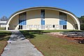
 Gordon R Holstun Gymnasium, R. E. Lee Institute.jpg 5,184 × 3,456; 7.51 MB
-
 Grand Plaza Park 1, Fitzgerald.jpg 5,184 × 3,456; 8.17 MB
-
 Grand Plaza Park 2, Fitzgerald.jpg 5,184 × 3,456; 6.15 MB
-
 Grand Plaza Park 3, Fitzgerald.jpg 5,184 × 3,456; 9.06 MB
-
 Grand Plaza Park 4, Fitzgerald.jpg 5,184 × 3,456; 8.58 MB
-
 Grand Plaza Park 5, Fitzgerald.jpg 5,184 × 3,456; 8.54 MB
-
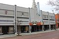 Grand Theater, Fitzgerald SE.jpg 5,184 × 3,456; 6.1 MB
-
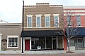 Granitoid building 100 block of E Pine St, Fitzgerald.jpg 5,184 × 3,456; 5.85 MB
-
 Granitoid building 100 block of S Main St, Fitzgerald.jpg 5,184 × 3,456; 5.7 MB
-
 Gresham Gym, Georgia Baptist Conference Center, Norman Park.jpg 5,184 × 3,456; 8.11 MB
-
 Gulfstream, Crossroads Business Center 1.jpg 5,184 × 3,456; 8.47 MB
-
 Gymnasium, Middle Georgia State University Macon campus.jpg 5,184 × 3,456; 9.43 MB
-
 Hageman House, Fitzgerald.jpg 5,184 × 3,456; 8.44 MB
-
 Hahira Depot 12 2017 (01).jpg 5,184 × 3,456; 8.11 MB
-
 Hahira Depot 12 2017 (04).jpg 5,184 × 3,456; 7.58 MB
-
 Hahira Depot 12 2017 (08).jpg 5,184 × 3,456; 7.59 MB
-
 Hahira Depot 12 2017 (10).jpg 5,184 × 3,456; 5.36 MB
-
 Hahira Depot 12 2017 (11).jpg 5,184 × 3,456; 5.24 MB
-
 Hahira Depot 12 2017 (13).jpg 5,184 × 3,456; 5.5 MB
-
 Hahira Depot 12 2017 (15).jpg 5,184 × 3,456; 4.99 MB
-
 Hahira Depot 12 2017 (17).jpg 5,184 × 3,456; 5.36 MB
-
 Hahira Depot 12 2017 (21).jpg 5,184 × 3,456; 5.79 MB
-
 Hahira Depot 12 2017 (23).jpg 5,184 × 3,456; 5.39 MB
-
 Hahira Depot 12 2017 (24).jpg 5,184 × 3,456; 6.68 MB
-
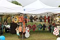
 Hahira Honeybee Festival 2017 03.jpg 5,184 × 3,456; 7.7 MB
-
 Hahira Honeybee Festival 2017 07.jpg 5,184 × 3,456; 7.07 MB
-
 Hahira Honeybee Festival 2017 10.jpg 5,184 × 3,456; 6.97 MB
-
 Hahira Honeybee Festival 2017 15.jpg 5,184 × 3,456; 6.57 MB
-
 Hahira Honeybee Festival 2017 19.jpg 5,184 × 3,456; 7.07 MB
-
 James Slaton Jay Shaw Memorial Highway, GA31, Lakeland.jpg 5,184 × 3,456; 8.83 MB
-
 Jesup City Hall.jpg 5,184 × 3,456; 7.47 MB
-
 Jesup City Limit US84EB.jpg 5,184 × 3,456; 6.92 MB
-
 Johnny Rocket's, Tanger Outlets Savannah.jpg 5,184 × 3,456; 6.4 MB
-
 Lee County border US19SB.jpg 5,184 × 3,456; 8.18 MB
-
 Long County border US84EB.jpg 5,184 × 3,456; 6.93 MB
-
 Looking east down Central Ave from SW corner of intersection with Grant St.jpg 5,184 × 3,456; 6.39 MB
-
 Looking west down Central Ave from NE corner of intersection with Grant St.jpg 5,184 × 3,456; 8.2 MB
-
 Ludowici city limit US84WB.jpg 5,184 × 3,456; 4.89 MB
-
 Ludowici city limit, US84EB.jpg 5,184 × 3,456; 6.74 MB
-
 Metro Diner, Tanger Outlets Savannah.jpg 5,184 × 3,456; 6.09 MB
-
 Miller County limit, US27NB.jpg 5,184 × 3,456; 6.2 MB
-
 Murray Crossing limit US84WB (Long County).jpg 5,184 × 3,456; 5.5 MB
-
 N Main St railroad crossing 638265T, Fitzgerald.jpg 5,184 × 3,456; 6.62 MB
-
 Odum railroad sign.jpg 5,184 × 3,456; 9.18 MB
-
 Offerman City Limit US84EB.jpg 5,184 × 3,456; 8.38 MB
-
 Offerman city limit US84WB.jpg 5,184 × 3,456; 9.48 MB
-
 Patterson City Limit US84EB.jpg 5,184 × 3,456; 8.74 MB
-
 Patterson city limit US84WB.jpg 5,184 × 3,456; 8.18 MB
-
 Pet Supermarket, Albany.jpg 5,184 × 3,456; 8.73 MB
-
 Pierce County border US84WB.jpg 5,184 × 3,456; 4.32 MB
-
 Pierce County, Big Satilla Creek bridge, GA15 121SB.jpg 5,184 × 3,456; 6.45 MB
-
 Railroad tracks looking East from N Clough Bay Road, Waresboro.jpg 5,184 × 3,456; 7.64 MB
-
 Screven City Limit US84EB.jpg 5,184 × 3,456; 8.32 MB
-
 Smithville city limit US19SB.jpg 5,184 × 3,456; 7.63 MB
-
 Smithville railroad sign.jpg 5,184 × 3,456; 7.4 MB
-
 Texas Roadhouse, Tanger Outlets Savannah.jpg 5,184 × 3,456; 7.69 MB
-
 To South Carolina sign on Whittaker St.jpg 5,184 × 3,456; 8.43 MB
-
 U.S. Route 301 SB turnoff from U.S. Route 84, Wayne County.jpg 5,184 × 3,456; 4.51 MB
-
 US 82 Overpass at N Slappey Blvd, Albany.jpg 5,184 × 3,456; 5.32 MB
-
 US84 WB 341 intersection, Jesup.jpg 5,184 × 3,456; 6.91 MB
-
 Wayne County border US84EB.jpg 5,184 × 3,456; 6.02 MB
-
 Wayne County Courthouse corner stone.jpg 5,184 × 3,456; 5.7 MB
-
 Zebulon city limit US19 SB.jpg 5,184 × 3,456; 8.19 MB
-
 Zebulon Pkwy US19 41.jpg 5,184 × 3,456; 4.86 MB


.jpg)
.jpg)
.jpg)
.jpg)
.jpg)
.jpg)
.jpg)
.jpg)
.jpg)
.jpg)
.jpg)


.jpg)


