Category:2020 United States House of Representatives election maps of Virginia
Jump to navigation
Jump to search
States of the United States: Arizona · California · Colorado · Illinois · Iowa · Kentucky · Michigan · New Mexico · Ohio · Oklahoma · Pennsylvania · South Carolina · Texas · Virginia · Wisconsin
Media in category "2020 United States House of Representatives election maps of Virginia"
The following 24 files are in this category, out of 24 total.
-

-
 2020 Congressional By County.svg 810 × 358; 76 KB
-

-

-

-

-

-

-

-

-

-
 VA1 House 2020.svg 800 × 1,004; 4.57 MB
-
 VA10 House 2020.svg 800 × 550; 2.69 MB
-
 VA11 House 2020.svg 800 × 1,473; 1.41 MB
-
 VA2 House 2020.svg 800 × 991; 3.18 MB
-
 VA3 House 2020.svg 800 × 734; 1.12 MB
-
 VA4 House 2020.svg 800 × 579; 3.16 MB
-
 VA5 House 2020.svg 800 × 951; 6.83 MB
-
 VA6 House 2020.svg 800 × 921; 4.47 MB
-
 VA7 House 2020.svg 800 × 1,786; 4.4 MB
-
 VA8 House 2020.svg 800 × 1,586; 1,012 KB
-
 VA9 House 2020.svg 1,052 × 744; 7.27 MB
-
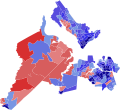
 2020 U.S. House elections in Virginia.svg 463 × 203; 223 KB
-
 Βουλευτικές εκλογές Ηνωμένων Πολιτειών 2020 - Βιρτζίνια.png 2,560 × 1,122; 54 KB


