Category:2023 aerial photographs of Main-Tauber-Kreis
Jump to navigation
Jump to search
Urban districts (cities): Heidelberg ·
English: 2023 aerial photographs of Main-Tauber-Kreis.
Deutsch: Luftbildfotografien aus dem Main-Tauber-Kreis von 2023.
Media in category "2023 aerial photographs of Main-Tauber-Kreis"
The following 3 files are in this category, out of 3 total.
-
 Aerial image of the Niederstetten air base.jpg 4,800 × 3,100; 5.67 MB
-
 Aerial image of the Tauberbischofsheim gliding site.jpg 4,000 × 3,000; 4.96 MB
-
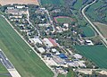 Hermann-Köhl-Kaserne (Niederstetten) beim Heeresflugplatz Niederstetten.jpg 2,133 × 1,533; 1.33 MB


_beim_Heeresflugplatz_Niederstetten.jpg)