Category:20th-century maps of Istanbul
Jump to navigation
Jump to search
Most populous urban areas of the world: Boston [US] · Cairo [EG] · Chicago [US] · Detroit [US] · Istanbul [TR] · London [GB] · Madrid [ES] · Moscow [RU] · New York City [US] · Paris [FR] · Philadelphia [US] · Saint Petersburg [RU] · San Francisco [US] · São Paulo [BR] · Singapore [SG] · Toronto [CA] · Washington, D.C. [US]

Subcategories
This category has the following 5 subcategories, out of 5 total.
Media in category "20th-century maps of Istanbul"
The following 4 files are in this category, out of 4 total.
-
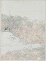 Konstantinopel - 47-41.jpg 3,816 × 5,010; 2.65 MB
-
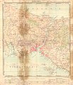
 Carteifea-2.jpg 446 × 379; 161 KB
-
 Galata'nın Topografik ve Arkeolojik Planı - A.M. Schneider und M. Is. Nomidis.png 1,981 × 1,244; 3.53 MB
-
 İstanbul - btv1b101005537.jpg 8,918 × 10,352; 12.03 MB


