Category:20th-century maps of Jerusalem
Jump to navigation
Jump to search
Subcategories
This category has only the following subcategory.
S
Media in category "20th-century maps of Jerusalem"
The following 62 files are in this category, out of 62 total.
-
 Heinrich Kiepert. Aegyptus. Phoenice et Palaestina (cropped).jpg 3,237 × 5,126; 3.53 MB
-
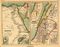 Heinrich Kiepert. Aegyptus. Phoenice et Palaestina.jpg 7,156 × 5,679; 7.19 MB
-
 Jerusalem area map 1903.jpg 491 × 628; 270 KB
-
 Map of jerusalem 1903.jpg 642 × 953; 136 KB
-

-

-

-

-

-

-
 Claude Reignier Conder, Ground plan of Jerusalem (FL6878525 3369663).jpg 2,104 × 2,908; 9.99 MB
-
 Modern Jerusalem Smith 1915.jpg 1,137 × 1,475; 390 KB
-
 Environs of Jerusalem .jpg Reproduced by the Survey of Egypt.jpg 852 × 727; 186 KB
-
 Patrick Geddes, 1919, Jerusalem - Town Planning Scheme No 2.png 5,162 × 3,859; 19.82 MB
-
 Jerusalem sketch plan of places of interest (FL165906165 0953816).jpg 2,066 × 3,076; 3.62 MB
-
 Jerusalem zoning system - Charles Robert Ashbee 1922.png 5,142 × 6,050; 38.6 MB
-
 JerusalemClose1943.jpg 600 × 459; 157 KB
-
 JerusalemSouth1943.jpg 1,073 × 1,321; 379 KB
-
 JerusalemWest1943.jpg 1,200 × 852; 290 KB
-
 Henry Kendall plan for Jerusalem 1944.png 4,861 × 6,593; 50.47 MB
-
 Jerusalem in third dimension designed and - edited by G.Frederick Owen... - btv1b532002316.jpg 12,221 × 7,623; 21.19 MB
-
 Jerusalem in Third Dimension.jpg 23,721 × 14,069; 134.75 MB
-
 Map of Qatamon, 1947.png 1,480 × 1,082; 2.22 MB
-
 DeirYassin1948.jpg 2,310 × 1,564; 980 KB
-
 1961 Jordan Tourism Map of Jerusalem.jpg 692 × 890; 151 KB
-
 Jerusalem, Pergamon World Atlas 1967.jpg 451 × 451; 65 KB
-
 Abudies-1933.jpg 6,584 × 4,962; 12.12 MB
-
 Atlas of ancient and classical geography (1909) (14595678750).jpg 3,488 × 2,023; 1.08 MB
-
 Birket Israel 1915.jpg 631 × 544; 91 KB
-
 Britannica Plan of Jerusalem.jpg 497 × 717; 72 KB
-
 Bukhariya1925.png 2,919 × 3,047; 844 KB
-
 Butler Palestina 2 E.jpg 703 × 937; 224 KB
-
 Clifford Holliday plan for Jerusalem 1930.jpg 4,994 × 7,061; 6.37 MB
-

-
 Ground plan of Jerusalem C.R. Conder Lt. R.E. del. ; W.&A.K. Johnston. Edinburgh..jpg 2,805 × 3,877; 1.83 MB
-
 Guide map of Jerusalem - Drawn by Survey Directorate H.Q. Pal & T.J-verso.jpg 1,041 × 1,425; 247 KB
-
 Handbook map of Jerusalem Reduced from the Ordnance Survey.jpg 1,165 × 1,169; 332 KB
-
 Jerusalem - btv1b10104219h.jpg 13,788 × 16,109; 38.73 MB
-
 Jerusalem - btv1b53198436g.jpg 13,036 × 14,007; 33.57 MB
-

-
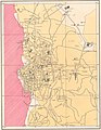
 Jerusalem Urban Plan 1968.png 9,288 × 7,584; 72.77 MB
-
 Jerusalem water supply - btv1b101042182.jpg 11,940 × 17,210; 32.2 MB
-
 Jerusalem-1907.jpg 2,165 × 1,739; 662 KB
-
 Kartenn Jeruzalem, 1903.png 1,715 × 1,486; 1.56 MB
-
 Map of Jerusalem - 1922 Jerh046.jpg 800 × 978; 154 KB
-
 Modern jerusalem 1915.jpg 2,592 × 3,198; 1.06 MB
-
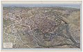
 RC panoranic 1930.jpg 800 × 656; 506 KB
-
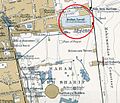
 SilwanBoundaries.jpg 1,500 × 1,822; 1.54 MB
-
 The 1944 SCHEME OPEN SPACE PLAN.jpg 6,551 × 4,614; 12.43 MB
-
 The Hebrew Association for Jerusalem, ירושלים (FL36006248 2367226).jpg 11,843 × 16,733; 271.87 MB
-
 The Hebrew Association for Jerusalem, ירושלים 01 (FL36006337 2369330).jpg 11,926 × 15,652; 249.3 MB
-
 The Hebrew Association for Jerusalem, ירושלים 02-index (FL36006342 2369330).jpg 15,864 × 11,864; 226.69 MB
-
 The Israel Land Development Company Ltd, ירושלם (FL42765507 2370083).jpg 16,783 × 18,139; 304.58 MB
-

-
 UN Map of Central Jerusalem November 1949.jpg 3,384 × 3,292; 2.23 MB
-
 WadiAlJoz1946.png 1,179 × 1,126; 1.07 MB
-
 West Bank (997009453383705171).jpg 2,000 × 1,237; 528 KB
-
 West Bank and east Jerusalem, population, January 1992. LOC 92684609.jpg 12,246 × 16,423; 11.57 MB
-
 West Bank and east Jerusalem, population, January 1992. LOC 92684609.tif 12,246 × 16,423; 575.4 MB
-
 MountZion1946.jpg 890 × 605; 215 KB
-
 Рисунок к статье «Иерусалим». Город времён Крестовых походов. ВЭС (СПб, 1911-1915).jpg 1,691 × 1,977; 1,011 KB
-
 Рисунок к статье «Иерусалим». Город современный. ВЭС (СПб, 1911-1915).jpg 1,781 × 2,000; 1.08 MB
.jpg)


_(14586894238).jpg)
_(14781447971).jpg)
_(14784593655).jpg)
_(14804442833).jpg)
_(14594005020).jpg)
_(14778352484).jpg)
.jpg)


.jpg)


_(14595678750).jpg)


.jpg)
.jpg)
.jpg)
.jpg)


.jpg)


.jpg)
.jpg)