Category:20th-century maps of Libya
Jump to navigation
Jump to search
Countries of Africa: Algeria · Angola · Benin · Botswana · Burkina Faso · Burundi · Cameroon · Cape Verde · Central African Republic · Chad · Comoros · Democratic Republic of the Congo · Republic of the Congo · Djibouti · Egypt‡ · Equatorial Guinea · Eritrea · Eswatini · Ethiopia · Gabon · The Gambia · Ghana · Guinea · Guinea-Bissau · Ivory Coast · Kenya · Lesotho · Liberia · Libya · Madagascar · Malawi · Mali · Mauritania · Morocco · Mozambique · Namibia · Niger · Nigeria · Rwanda · São Tomé and Príncipe · Senegal · Sierra Leone · Somalia · South Africa · South Sudan · Sudan · Tanzania · Togo · Tunisia · Uganda · Zambia · Zimbabwe
Limited recognition: Somaliland – Other areas: Canary Islands · Madeira · Western Sahara
‡: partly located in Africa
Limited recognition: Somaliland – Other areas: Canary Islands · Madeira · Western Sahara
‡: partly located in Africa
Subcategories
This category has the following 7 subcategories, out of 7 total.
- 1910s maps of Libya (5 F)
- 1930s maps of Libya (4 F)
Media in category "20th-century maps of Libya"
The following 7 files are in this category, out of 7 total.
-

-
 1940 German military map - Übersichtskarte Athen-Alexandrien.jpg 24,741 × 32,540; 98.28 MB
-
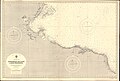
 Admiralty Chart No 176 Cap Bon to Tòbruch, Published 1969.jpg 13,733 × 8,379; 18.09 MB
-
 Admiralty Chart No 176 Kerkenah Islands to Ras Misurata, Published 1941.jpg 16,296 × 11,057; 72.48 MB
-
 Admiralty Chart No 3354 Sirte to Tolmeita, Published 1937.jpg 16,346 × 11,061; 49.81 MB
-
 Air Defense Map of Libya, 1989.png 612 × 759; 83 KB
-
 Battle of Derna Eaton route.tif 2,149 × 1,082; 479 KB
%27_(11151880115).jpg)


