Category:20th-century maps of the Black Sea
Jump to navigation
Jump to search
Media in category "20th-century maps of the Black Sea"
The following 45 files are in this category, out of 45 total.
-
 Stanford, Edward. Asia Minor, Caucasus, Black Sea. 1901 (M).jpg 3,005 × 1,937; 1.71 MB
-
 Carte de La « Riviera » Russe.jpg 337 × 366; 41 KB
-
 Russian map of the Black Sea 1806-1812.jpg 1,554 × 820; 128 KB
-
 Russland BV042516962.jpg 1,529 × 2,628; 372 KB
-
 Schwarzes Meer BV043421912.jpg 2,701 × 1,637; 388 KB
-
 W. & A.K. Johnston. Asia Minor. 1911 G.jpg 2,459 × 1,130; 559 KB
-
-
-
 1915 map - Flemmings Kriegskarte - Dardanellen, Bosporus und die Europäische Türkei.tif 10,149 × 8,312; 36.65 MB
-
 20-Dardanellen, Bosporus und die europäische Türkei (1915).png 12,082 × 9,917; 150.19 MB
-
 1915 bird's eye view map - Carte panoramique en relief des Balkans.jpg 7,024 × 4,784; 4.97 MB
-
 1915 bird's eye view map of the Dardanelles.jpg 6,704 × 5,464; 5.63 MB
-
 1916 bird's eye view map - Dall'Adriatico al Mar Nero.jpg 11,886 × 8,284; 13.98 MB
-
 Фрагмент карты Грузии И.Джавахишвили. 1919 г.jpg 372 × 520; 49 KB
-

-

-
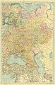 1921 map of Russia.jpg 7,448 × 11,500; 16.51 MB
-

-
 Near East & India 1930, svatlas cropped.jpg 882 × 637; 345 KB
-
 1940 German military map - Übersichtskarte Charkow-Batum.jpg 24,662 × 32,395; 123.02 MB
-

-
-
 Admiralty Chart Catalogue 1967 Page 036 Index F.jpg 8,582 × 6,860; 9.85 MB
-
 Admiralty Chart Catalogue 1967 Page 043.jpg Index F2.jpg 8,576 × 6,862; 8.19 MB
-
 Soviet Union 1967 - European part south.jpg 4,068 × 2,894; 3.04 MB
-
 A Map of the Earliest Known Civilizations.jpg 2,050 × 3,042; 652 KB
-
 Admiralty Chart No 2285 Plans in the Black Sea, Published 1904.jpg 8,303 × 11,056; 34.37 MB
-
 Black sea crimean war.jpg 1,674 × 1,023; 478 KB
-
 Butler Obris Veteribus Notus A.jpg 783 × 581; 174 KB
-
 Christians in the Black Sea region (1896).JPG 956 × 636; 67 KB
-
 D019-Pont-Euxin.-L2-Ch4.png 1,510 × 1,260; 298 KB
-
 D021-Empire de Mithridate.-L2-Ch4.png 1,510 × 1,838; 390 KB
-
 Democratic Ideals and Reality, 1919 Fig 25 p 137.jpg 1,959 × 1,337; 284 KB
-
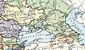
 Europe 1911 Caucasus and the Black Sea.jpg 887 × 591; 144 KB
-
 Europe map 1919 cropped.JPG 738 × 437; 120 KB
-
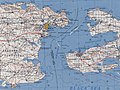
 Gardiner814 (A).JPG 523 × 426; 88 KB
-
 Map of Pontus.jpg 3,289 × 2,122; 1.03 MB
-
 Map of Pontus.png 640 × 290; 141 KB
-
 NL 36-07.jpg 5,743 × 4,365; 6.41 MB
-
 Pontus.png 1,500 × 1,200; 1.2 MB
-
 Republic of Pontus map.svg 760 × 491; 111 KB
-

-
 Shepherd-c-018-019 cropped Caucasus.JPG 727 × 570; 169 KB
-
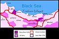
 Vize from Turkey 1 to 250,000.jpg 8,898 × 6,940; 6.82 MB
-
 Кавказ.jpg 1,034 × 1,097; 409 KB
.jpg)


.jpg)
.png)


.jpg)


.JPG)


.JPG)


_(14762785394).jpg)


