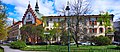
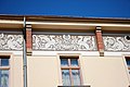
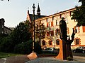
Category:26 Garncarska Street in Kraków
Jump to navigation
Jump to search
| Object location | | View all coordinates using: OpenStreetMap |
|---|
.JPG) | |||||
| Upload media | |||||
| Instance of | |||||
|---|---|---|---|---|---|
| Location | Kraków, Lesser Poland Voivodeship, Poland | ||||
| Street address |
| ||||
| Heritage designation |
| ||||
| Inception |
| ||||
| Significant event |
| ||||
 | |||||
Polski: budynek klasztorny, 1895-1896
| Address |
|
Media in category "26 Garncarska Street in Kraków"
The following 12 files are in this category, out of 12 total.
-
-
 Kraków, Garncarska 24-26 (1).JPG 4,752 × 3,168; 5.46 MB
-
 Kraków, Garncarska 24-26 (13).JPG 4,752 × 3,168; 7.04 MB
-
 Kraków, Garncarska 24-26 (14).JPG 4,752 × 3,168; 6.42 MB
-
 Kraków, Garncarska 24-26 (15).JPG 4,752 × 3,168; 5.58 MB
-
 Kraków, Garncarska 24-26 (16).JPG 4,752 × 3,168; 4.59 MB
-
 Kraków, Garncarska 24-26 (17).JPG 4,752 × 3,168; 4.29 MB
-
 Kraków, Garncarska 24-26 (18).JPG 3,168 × 4,752; 5.7 MB
-
 Kraków, Garncarska 24-26 (19).JPG 4,752 × 3,168; 4.06 MB
-
 Kraków, Garncarska 24-26 (20).JPG 3,168 × 4,752; 5.66 MB
-
 Kraków, Garncarska 24-26 (21).JPG 4,752 × 3,168; 5.52 MB
-
 Monastery of Holy Heart of Jesus in Kraków.JPG 3,456 × 2,592; 3.87 MB

.JPG)
.JPG)
.JPG)
.JPG)
.JPG)
.JPG)
.JPG)
.JPG)
.JPG)
