Category:4 Wojska Polskiego Street in Janowice Wielkie
Jump to navigation
Jump to search
| Object location | | View all coordinates using: OpenStreetMap |
|---|
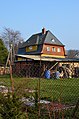
garden in Janowice Wielkie, Poland  | |||||
| Upload media | |||||
| Instance of | |||||
|---|---|---|---|---|---|
| Part of | |||||
| Location | Janowice Wielkie, Gmina Janowice Wielkie, Karkonosze County, Lower Silesian Voivodeship, Poland | ||||
| Street address |
| ||||
| Heritage designation |
| ||||
| Inception |
| ||||
 | |||||
Polski: Janowice Wielkie, ul. Wojska Polskiego 4 - zespół willi, 1870-1880:
- willa, ok. 1920 (591850)
- ogród, ok. 1920 (591851)
Media in category "4 Wojska Polskiego Street in Janowice Wielkie"
The following 4 files are in this category, out of 4 total.
-
 Janowice Wielkie, ul. Wojska Polskiego 4 0195.jpg 4,928 × 3,264; 8.64 MB
-
 Janowice Wielkie, ul. Wojska Polskiego 4 0197.jpg 4,086 × 3,113; 6.94 MB
-
 Janowice Wielkie, ul. Wojska Polskiego 4 0202.jpg 3,264 × 4,928; 7.92 MB
-
 Janowice Wielkie, ul. Wojska Polskiego 4 0205.jpg 2,768 × 4,208; 7.01 MB


