Category:A' Mharconaich
Jump to navigation
Jump to search
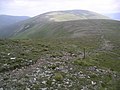
English: A' Mharconaich is a Scottish mountain that is located 29 km WNW of Blair Atholl in the Highland council area. It is in a group of mountains that lie west of the A9 road near the summit of the Pass of Drumochter and are known accordingly as the Drumochter Hills. The hill is just within the Cairngorms National Park although it is not part of the Cairngorms mountains.
Norsk bokmål: A' Mharconaich er et fjell i Skottland, det ligger i fjellrekken Grampian-fjellene i regionen Highland. A' Mharconaich har en høyde på 975 meter over havet. Det har en primærfaktor på 114.
Polski: A'Mharconaich – szczyt w paśmie West Drumochter, w Grampianach Centralnych. Leży w Szkocji, w regionie Highland.
973m high mountain in Highland, Scotland, UK  | |||||
| Upload media | |||||
| Instance of | |||||
|---|---|---|---|---|---|
| Location | Highland, Scottish Highlands, Scotland | ||||
| Mountain range | |||||
| Topographic prominence |
| ||||
| Elevation above sea level |
| ||||
 | |||||
Media in category "A' Mharconaich"
The following 32 files are in this category, out of 32 total.
-
 A Mharconaich from the south.jpg 1,600 × 1,200; 337 KB
-
 A'Mharconaich - geograph.org.uk - 333723.jpg 640 × 391; 36 KB
-
 A'Mharconaich - geograph.org.uk - 333731.jpg 640 × 434; 42 KB
-
 A'Mharconaich - geograph.org.uk - 333738.jpg 640 × 437; 50 KB
-
 A'Mharconaich - geograph.org.uk - 333744.jpg 640 × 459; 35 KB
-
 A'Mharconaich - geograph.org.uk - 333796.jpg 640 × 455; 18 KB
-
 A'Mharconaich, Geal Charn Bealach - geograph.org.uk - 333754.jpg 640 × 475; 36 KB
-
 A’Mharconaich.jpg 4,272 × 2,840; 2.74 MB
-
 Ben Alder - geograph.org.uk - 333741.jpg 640 × 478; 69 KB
-
 Drumochter Pass from Boar of Badenoch.jpg 2,304 × 1,728; 395 KB
-

-
 Heading south off Geal-charn - geograph.org.uk - 1670961.jpg 1,000 × 648; 234 KB
-
 Loch Pattack and Ericht from AM.jpg 1,400 × 1,050; 386 KB
-
 Path to A' Mharconaich - geograph.org.uk - 235616.jpg 640 × 480; 120 KB
-
 The Boar of Badenoch - geograph.org.uk - 3389295.jpg 640 × 480; 98 KB
-

-
 View north towards Geal Charn - geograph.org.uk - 1518923.jpg 640 × 394; 101 KB
-
 Western flanks of A'Mharconaich - geograph.org.uk - 1242301.jpg 640 × 480; 94 KB
-
 A' Mharconaich - geograph.org.uk - 481578.jpg 640 × 480; 73 KB
-
 Boar of Badenoch - geograph.org.uk - 353420.jpg 640 × 443; 73 KB
-

-
 Druim Uachdair - geograph.org.uk - 482008.jpg 640 × 480; 71 KB
-
 Drummochter Pass from East - geograph.org.uk - 583854.jpg 640 × 480; 73 KB
-
 Fraoch-choire - geograph.org.uk - 235625.jpg 640 × 480; 138 KB
-
 Geal-charn (917m) - geograph.org.uk - 126326.jpg 640 × 471; 98 KB
-
 Moorland opposite Druim Uachdair - geograph.org.uk - 659385.jpg 640 × 480; 71 KB
-
 NE slopes of A'Mharconaich - geograph.org.uk - 24941.jpg 640 × 421; 77 KB
-

-
 On the tops - geograph.org.uk - 333748.jpg 640 × 461; 43 KB
-
 Slopes of A' Mharconaich - geograph.org.uk - 659540.jpg 640 × 480; 38 KB
-
 Summit cairn - Boar of Badenoch. - geograph.org.uk - 353437.jpg 640 × 397; 52 KB
-


_-_geograph.org.uk_-_126326.jpg)


