Category:A360 road (England)
Jump to navigation
Jump to search
road in England | |||||
| Upload media | |||||
| Instance of | |||||
|---|---|---|---|---|---|
| Location |
| ||||
| Transport network |
| ||||
| Length |
| ||||
 | |||||
Media in category "A360 road (England)"
The following 18 files are in this category, out of 18 total.
-
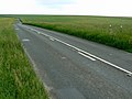
 2010 - Gore Cross on the A360 - geograph.org.uk - 2196490.jpg 4,169 × 3,035; 4.27 MB
-

-

-
 A360 heading south near Potterne - geograph.org.uk - 1279095.jpg 640 × 545; 229 KB
-
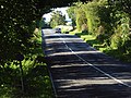
 A360 heading south to Littleton Panell - geograph.org.uk - 1279048.jpg 640 × 487; 185 KB
-
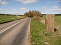
 A360 towards Shrewton - geograph.org.uk - 454123.jpg 1,600 × 1,200; 618 KB
-
 St Mary's Church - Northgate - geograph.org.uk - 945968.jpg 527 × 640; 237 KB
-
 George V Postbox, Salisbury - geograph.org.uk - 917194.jpg 480 × 640; 101 KB
-
 Littleton Panell.JPG 2,272 × 1,704; 1.15 MB
-

-
 The A360 - geograph.org.uk - 489492.jpg 640 × 480; 156 KB
-
 The A360 - geograph.org.uk - 491332.jpg 640 × 480; 161 KB
-
 The A360 - geograph.org.uk - 491337.jpg 640 × 480; 176 KB
-
 UK road A360.PNG 597 × 184; 10 KB
-
 Water tower, Druid's Head - geograph.org.uk - 1036093.jpg 640 × 480; 94 KB
-

-
-
 Winterbourne Stoke - Airmans Cross - geograph.org.uk - 1718093.jpg 1,024 × 768; 200 KB


