Category:A Kung Ngam Village Lane
Jump to navigation
Jump to search
| Object location | | View all coordinates using: OpenStreetMap |
|---|
中文:阿公岩村里
Subcategories
This category has the following 4 subcategories, out of 4 total.
Media in category "A Kung Ngam Village Lane"
The following 6 files are in this category, out of 6 total.
-
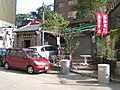
 HK A Kung Ngam Village Lane 02.JPG 1,600 × 1,200; 1.11 MB
-
 HK A Kung Ngam Village Lane Public Notice.JPG 1,200 × 1,600; 1.14 MB
-
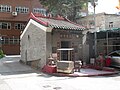
 HK A Kung Ngam Village Road Temple 02.JPG 1,600 × 1,200; 1.13 MB
-
 Yuk Wong Kung Din, Shau Kei Wan (Hong Kong).jpg 2,250 × 3,000; 2.74 MB
-
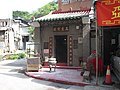
 Yuk Wong Temple 01.jpg 4,608 × 3,456; 3.86 MB
-
 Yuk Wong Temple 02.jpg 4,608 × 3,456; 3.5 MB


.jpg)

