Category:Abandoned buildings in West Yorkshire
Jump to navigation
Jump to search
Subcategories
This category has the following 9 subcategories, out of 9 total.
Media in category "Abandoned buildings in West Yorkshire"
The following 14 files are in this category, out of 14 total.
-
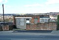
 Abandoned Brick Building, Westgate Hill - geograph.org.uk - 5812412.jpg 5,184 × 3,456; 7.16 MB
-
 Abandoned Buildings below Soil Hill - geograph.org.uk - 5204172.jpg 1,600 × 1,067; 394 KB
-
 Abandoned farm, above Baitings Reservoir (1968207696).jpg 1,448 × 1,780; 1,012 KB
-
 Abandoned hut on Reaps Hill - geograph.org.uk - 2561997.jpg 3,872 × 2,592; 6.55 MB
-
 Abandoned in Halifax (10969282814).jpg 2,733 × 2,828; 6.95 MB
-
 Abandoned school Thornhill - geograph.org.uk - 5684978.jpg 1,024 × 768; 279 KB
-
 Disused community centre, Hanging Heaton, Soothill - geograph.org.uk - 1929586.jpg 2,000 × 1,364; 503 KB
-
 Disused Pavilion - off Raikes Lane - geograph.org.uk - 2863619.jpg 640 × 480; 89 KB
-
 Disused Stable - Half Mile Lane - geograph.org.uk - 2214884.jpg 640 × 453; 96 KB
-
 Empty Factory, Sunny Bank Road, Brighouse - geograph.org.uk - 150696.jpg 640 × 477; 108 KB
-
 Kirk Cliff, Doorway - geograph.org.uk - 1129395.jpg 470 × 628; 198 KB
-
 Pad Laithe - geograph.org.uk - 1270673.jpg 480 × 640; 105 KB
-
 Paddock Saddlery - geograph.org.uk - 1390320.jpg 640 × 480; 75 KB
-


.jpg)

.jpg)


