Category:Abbey St Bathans (civil parish)
Jump to navigation
Jump to search
Scottish parish in Scottish Borders, Scotland, UK | |||||
| Upload media | |||||
| Instance of | |||||
|---|---|---|---|---|---|
| Part of |
| ||||
| Named after | |||||
| Location |
| ||||
| Population |
| ||||
| Area |
| ||||
 | |||||
Media in category "Abbey St Bathans (civil parish)"
The following 200 files are in this category, out of 260 total.
(previous page) (next page)-
 18thC tombstone - geograph.org.uk - 4109586.jpg 505 × 640; 144 KB
-

-
 A face in the woods - geograph.org.uk - 3814450.jpg 639 × 640; 209 KB
-
 A grazing field at Quixwood - geograph.org.uk - 5621631.jpg 1,024 × 683; 934 KB
-
 A sign at Quixwood Moor Windfarm site entrance - geograph.org.uk - 5621636.jpg 1,024 × 688; 676 KB
-
 A survivor by the Whiteadder Water - geograph.org.uk - 3814454.jpg 640 × 500; 170 KB
-

-
 Abbey St Bathans Ford - geograph.org.uk - 5829203.jpg 3,000 × 2,000; 6.47 MB
-
 Abbey St Bathans from the footbridge - geograph.org.uk - 2994751.jpg 800 × 533; 176 KB
-
 Abbey St Bathans Kirk - geograph.org.uk - 4939287.jpg 640 × 455; 175 KB
-
 Abbey St. Bathans House - geograph.org.uk - 4579142.jpg 800 × 600; 122 KB
-
 Abbey St. Bathans Kirk - geograph.org.uk - 6211767.jpg 1,600 × 996; 363 KB
-

-
 Abbey St. Bathans Parish Kirk - geograph.org.uk - 4109579.jpg 640 × 480; 93 KB
-
 Abbey St. Bathans Parish Kirk - geograph.org.uk - 4109582.jpg 640 × 480; 97 KB
-
 Afforested course of Whare Burn near Luckie Shiel - geograph.org.uk - 6440342.jpg 5,184 × 3,888; 7.06 MB
-

-
 Ancient roadside oaks in Monynut - geograph.org.uk - 6370393.jpg 3,128 × 2,346; 2.55 MB
-
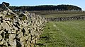
 Auld dyke in Monynut - geograph.org.uk - 6370413.jpg 3,128 × 2,346; 2.5 MB
-
 Barn at Abbey St Bathans - geograph.org.uk - 3096677.jpg 3,264 × 2,448; 3.82 MB
-
 Barnside farm - geograph.org.uk - 5835277.jpg 1,600 × 1,060; 440 KB
-
 Bench Mark, Whiteburn Bridge - geograph.org.uk - 2616127.jpg 480 × 640; 83 KB
-
 Beside the Monynut Water - geograph.org.uk - 6417012.jpg 1,024 × 768; 457 KB
-
 Beside the White Burn - geograph.org.uk - 6346317.jpg 1,024 × 576; 269 KB
-
 Black cattle, Barnside - geograph.org.uk - 5835468.jpg 1,600 × 949; 412 KB
-
 Blakerstone Moor - geograph.org.uk - 1776872.jpg 640 × 359; 93 KB
-
 Brush Wood - geograph.org.uk - 6417008.jpg 1,024 × 768; 480 KB
-
 Burn near Elba - geograph.org.uk - 3383209.jpg 640 × 480; 264 KB
-

-
 Butterdean and Roadside Woods in the Scottish Borders - geograph.org.uk - 6393704.jpg 5,184 × 3,888; 4.8 MB
-

-
 Cattle near Abbey St Bathans - geograph.org.uk - 2616181.jpg 640 × 481; 70 KB
-
 Caution sign near Elba - geograph.org.uk - 2993554.jpg 533 × 800; 217 KB
-
 Clearance, Blackerstone Moor - geograph.org.uk - 4401126.jpg 640 × 426; 53 KB
-
 Cleared snow, Moorhouse - geograph.org.uk - 3383249.jpg 640 × 480; 271 KB
-
 Closed telephone box, Abbey St Bathan's - geograph.org.uk - 6346822.jpg 1,024 × 683; 353 KB
-
-

-
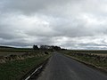
 Country road towards Bankhead - geograph.org.uk - 1230385.jpg 640 × 480; 64 KB
-
 Crop field towards Woodland - geograph.org.uk - 4470012.jpg 640 × 480; 65 KB
-
 Deil's Neuk - geograph.org.uk - 1771107.jpg 640 × 359; 101 KB
-
 Deil's Neuk - geograph.org.uk - 1913463.jpg 640 × 480; 103 KB
-
 Descent towards the A6112 - geograph.org.uk - 4480471.jpg 640 × 480; 96 KB
-
 Detail, The Kirk at Abbey St Bathans - geograph.org.uk - 2619401.jpg 479 × 640; 80 KB
-
 Drainage ditch near Luckie Shiel in the Scottish Borders - geograph.org.uk - 6252347.jpg 5,184 × 3,888; 6.55 MB
-

-
 Dyke and sessile oaks by minor road in the Scottish Borders - geograph.org.uk - 6370409.jpg 3,128 × 2,346; 2.57 MB
-
-
 Elba Ford - geograph.org.uk - 5829186.jpg 3,000 × 2,000; 7.5 MB
-
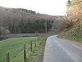
 Ellemford - Abbey St Bathans road - geograph.org.uk - 1767580.jpg 640 × 359; 68 KB
-
 Ellemford - Abbey St Bathans road - geograph.org.uk - 1776860.jpg 640 × 359; 94 KB
-
 Ellerburn Wood - geograph.org.uk - 6211741.jpg 1,600 × 1,035; 186 KB
-

-
 Ewes and lambs near Quixwood - geograph.org.uk - 2615618.jpg 640 × 481; 82 KB
-
 Ewes and lambs, Abbey St Bathans - geograph.org.uk - 1776867.jpg 640 × 480; 96 KB
-
 Eye sight near Grantshouse in the Scottish Borders - geograph.org.uk - 6383333.jpg 3,128 × 2,346; 2.51 MB
-
 Eye Water in the Scottish Borders - geograph.org.uk - 6383602.jpg 5,184 × 3,888; 7.02 MB
-
 Eye Water near Grantshouse - geograph.org.uk - 2615606.jpg 640 × 480; 75 KB
-
 Farm buildings at Abbey St Bathans - geograph.org.uk - 3096588.jpg 3,264 × 2,448; 4.56 MB
-

-

-
 Farm road to Godscroft - geograph.org.uk - 1249516.jpg 640 × 480; 95 KB
-
 Farm road, Abbey St Bathans - geograph.org.uk - 1767569.jpg 640 × 359; 70 KB
-
 Farm track fording the Monynut Water - geograph.org.uk - 1249487.jpg 640 × 480; 125 KB
-
 Farm track, Moorhouse - geograph.org.uk - 4480463.jpg 640 × 480; 82 KB
-
 Farmland at Abbey St Bathans - geograph.org.uk - 4939300.jpg 640 × 427; 180 KB
-
 Farmland by Edin's Hall - geograph.org.uk - 1722589.jpg 640 × 359; 47 KB
-
 Farmland near Blackerstone - geograph.org.uk - 4470021.jpg 640 × 480; 73 KB
-
 Farmland near Blackerstone - geograph.org.uk - 4480470.jpg 640 × 480; 83 KB
-
 Farmland towards Hill Wood - geograph.org.uk - 4470015.jpg 640 × 480; 76 KB
-

-
 Field entrance near Whiteburn - geograph.org.uk - 4468706.jpg 640 × 480; 78 KB
-
 Field, Blackerstone Moor - geograph.org.uk - 4401131.jpg 800 × 533; 169 KB
-
 Fish farm at Abbey St Bathans - geograph.org.uk - 6212193.jpg 1,600 × 1,200; 383 KB
-
 Footbridge over the Whiteadder Water - geograph.org.uk - 4109594.jpg 640 × 480; 101 KB
-
 Footbridge over the Whiteadder Water - geograph.org.uk - 4905539.jpg 3,240 × 4,320; 3.82 MB
-
 Footbridge over Whiteadder Water - geograph.org.uk - 2616488.jpg 480 × 640; 72 KB
-
 Footbridge over Whiteadder Water - geograph.org.uk - 6211753.jpg 1,600 × 1,186; 423 KB
-
 Footbridge, Abbey St Bathans - geograph.org.uk - 1842024.jpg 480 × 640; 132 KB
-
 Footbridge, Abbey St Bathans - geograph.org.uk - 2994742.jpg 800 × 533; 166 KB
-
 Footbridge, Abbey St Bathans - geograph.org.uk - 3166291.jpg 800 × 530; 135 KB
-
 Footbridge, Catcleugh Burn - geograph.org.uk - 5835475.jpg 1,600 × 1,060; 660 KB
-
 Footpath bridge over the Whiteadder Water - geograph.org.uk - 3096669.jpg 3,264 × 2,448; 5.05 MB
-
 Footpath by the Whiteadder Water - geograph.org.uk - 2618342.jpg 640 × 480; 75 KB
-
 Footpath to Edgar's Cleugh - geograph.org.uk - 2615744.jpg 640 × 481; 91 KB
-
 Ford at Abbey St Bathans - geograph.org.uk - 2993095.jpg 800 × 533; 214 KB
-
 Ford at Abbey St Bathans - geograph.org.uk - 3096650.jpg 3,264 × 2,448; 5.34 MB
-
 Ford at Abbey St Bathans - geograph.org.uk - 5829212.jpg 4,032 × 3,024; 3.6 MB
-
 Ford at Abbey St Bathans - geograph.org.uk - 6212195.jpg 1,600 × 1,200; 496 KB
-

-

-
 Forest track and feeder - geograph.org.uk - 5835794.jpg 1,600 × 1,060; 610 KB
-
 Forest track to Abbey St Bathans - geograph.org.uk - 5835789.jpg 1,600 × 1,060; 656 KB
-
 Gate off the A6112 - geograph.org.uk - 3336894.jpg 640 × 360; 234 KB
-
 Gatehouse to Abbey St Bathans House - geograph.org.uk - 6212199.jpg 1,600 × 1,082; 394 KB
-
 Gorse by Eller Burn - geograph.org.uk - 2619512.jpg 640 × 481; 79 KB
-

-
 Gorse near Abbey St Bathans - geograph.org.uk - 2619447.jpg 640 × 480; 74 KB
-
 Grassland, Abbey St Bathans - geograph.org.uk - 1767391.jpg 640 × 359; 90 KB
-
 Grassland, Blakerstone Moor - geograph.org.uk - 1776874.jpg 640 × 359; 70 KB
-

-
 Grazing, Blakerstone Moor - geograph.org.uk - 4480454.jpg 640 × 480; 61 KB
-
 Grazing, Moorhouse - geograph.org.uk - 4480464.jpg 640 × 478; 53 KB
-

-
 Hay feeders near Abbey St Bathans - geograph.org.uk - 2616215.jpg 640 × 482; 83 KB
-
 Heading south east towards Moorhouse - geograph.org.uk - 4480461.jpg 640 × 480; 62 KB
-
 Hill Plantation - geograph.org.uk - 4401086.jpg 800 × 533; 308 KB
-
 Horse if field in front of Retreat House - geograph.org.uk - 3950715.jpg 4,000 × 2,248; 2.42 MB
-
 Horses and the kirk, Abbey St Bathans - geograph.org.uk - 5835262.jpg 1,600 × 1,060; 525 KB
-
 House in the trees - geograph.org.uk - 6212201.jpg 1,600 × 1,080; 465 KB
-
 Iron chicken - geograph.org.uk - 6346842.jpg 1,024 × 683; 391 KB
-
 Kirk of Lammermuir, Abbey St Bathans - geograph.org.uk - 3166302.jpg 800 × 530; 168 KB
-

-
 Logs, Moorhouse - geograph.org.uk - 3383244.jpg 640 × 480; 256 KB
-
 Looking downstream, Eye Water - geograph.org.uk - 4401070.jpg 800 × 450; 158 KB
-
 Minor road above White Gate Wood - geograph.org.uk - 3166213.jpg 800 × 530; 101 KB
-
 Minor road at Abbey St Bathans - geograph.org.uk - 1173626.jpg 640 × 480; 151 KB
-

-
 Minor road junction, Quixwood Moor - geograph.org.uk - 4480438.jpg 640 × 480; 50 KB
-
 Minor road near Blackerston - geograph.org.uk - 3383240.jpg 640 × 480; 256 KB
-
 Minor road near Blackerstone - geograph.org.uk - 4480468.jpg 640 × 480; 57 KB
-
 Minor road near Moorhouse - geograph.org.uk - 4480466.jpg 640 × 480; 55 KB
-
 Minor road near Quixwood - geograph.org.uk - 1032005.jpg 640 × 360; 54 KB
-
 Minor road towards Blackerstone - geograph.org.uk - 4480467.jpg 640 × 480; 48 KB
-
 Minor road, Blackerstone - geograph.org.uk - 3383231.jpg 640 × 480; 259 KB
-
 Minor road, Blakerstone Moor - geograph.org.uk - 4480455.jpg 640 × 480; 62 KB
-
 Minor road, Blakerstone Moor - geograph.org.uk - 4480457.jpg 640 × 480; 73 KB
-
 Minor road, Moorhouse - geograph.org.uk - 4480465.jpg 640 × 480; 71 KB
-
 Minor roads junction near Whiteburn - geograph.org.uk - 6255835.jpg 4,608 × 3,456; 4.65 MB
-
 Molehills near Mill Brae - geograph.org.uk - 2616202.jpg 640 × 480; 85 KB
-

-
 Moorhouse - geograph.org.uk - 4470013.jpg 640 × 480; 119 KB
-

-
 Narrow road with few passing places - geograph.org.uk - 6211788.jpg 1,600 × 1,200; 455 KB
-
 Near Blackerstone Cottage - geograph.org.uk - 4470018.jpg 640 × 480; 89 KB
-
 New hedge at Barnside - geograph.org.uk - 2616235.jpg 640 × 480; 93 KB
-
 Newly graded track - geograph.org.uk - 6346854.jpg 1,024 × 683; 225 KB
-
 Oak wood, Shannobank - geograph.org.uk - 6346821.jpg 1,024 × 683; 351 KB
-
 Old hall, Abbey St Bathans - geograph.org.uk - 5835264.jpg 1,600 × 1,060; 551 KB
-

-

-
 Palindromic road sign - geograph.org.uk - 3096686.jpg 3,264 × 2,448; 5.98 MB
-
 Parish church at Abbey St Bathans - geograph.org.uk - 4905545.jpg 3,730 × 2,698; 2.35 MB
-
 Path junction, Abbey St. Bathans - geograph.org.uk - 1032012.jpg 640 × 360; 76 KB
-
 Path through Abbey St. Bathans - geograph.org.uk - 4109602.jpg 640 × 480; 112 KB
-
 Philip Rig - geograph.org.uk - 1913478.jpg 640 × 480; 120 KB
-
 Pleasantly afforested Whare Burn near Luckie Shiel - geograph.org.uk - 6440335.jpg 5,184 × 3,888; 7.24 MB
-
 Postbox, Abbey St Bathans - geograph.org.uk - 2619420.jpg 479 × 640; 108 KB
-
 Power line, Edgar's Cleuch - geograph.org.uk - 6346852.jpg 1,024 × 683; 244 KB
-
 Power lines and farmland, Blackerstone - geograph.org.uk - 3166249.jpg 800 × 530; 112 KB
-
 Quixwood - geograph.org.uk - 6346859.jpg 1,024 × 683; 235 KB
-
 Rapids on Whiteadder Water - geograph.org.uk - 6212214.jpg 1,600 × 1,200; 580 KB
-
 Retreat House - geograph.org.uk - 1174000.jpg 640 × 360; 69 KB
-
 Retreat House - geograph.org.uk - 3950682.jpg 4,000 × 2,248; 3.96 MB
-
 Retreat House and Daffodils - geograph.org.uk - 3950719.jpg 4,000 × 2,248; 3.03 MB
-
 Retreat House at Abbey St Bathans - geograph.org.uk - 3096606.jpg 3,264 × 2,448; 5.02 MB
-
 Retreat House from Edin's Hall - geograph.org.uk - 3096357.jpg 3,264 × 2,448; 6.07 MB
-
 Retreat House in the Whiteadder valley - geograph.org.uk - 3096254.jpg 3,264 × 2,448; 5.49 MB
-
 Retreat Wood - geograph.org.uk - 3814461.jpg 640 × 427; 189 KB
-
 River Whiteadder above Abbey St Bathans - geograph.org.uk - 3887317.jpg 4,608 × 3,456; 5.88 MB
-
 Riverside Restaurant - geograph.org.uk - 4109599.jpg 640 × 480; 98 KB
-
 Road bridge over Whiteadder Water - geograph.org.uk - 6255816.jpg 4,608 × 3,456; 5.82 MB
-
 Road bridge, Abbey St Bathans - geograph.org.uk - 5835266.jpg 1,600 × 1,060; 404 KB
-
 Road near Blakerstone Moor - geograph.org.uk - 1224367.jpg 640 × 480; 63 KB
-
 Road over Shannabank Hill - geograph.org.uk - 6346323.jpg 1,024 × 576; 194 KB
-
 Road sign and snow drifts - geograph.org.uk - 3384384.jpg 640 × 480; 235 KB
-
 Road sign, Moorhouse - geograph.org.uk - 3384372.jpg 640 × 480; 264 KB
-
 Road to Abbey St Bathan's - geograph.org.uk - 6346818.jpg 1,024 × 683; 411 KB
-
 Road to Godscroft - geograph.org.uk - 6346324.jpg 1,024 × 576; 229 KB
-
 Road, Blackerstone Moor - geograph.org.uk - 3383253.jpg 640 × 480; 251 KB
-
 Road, Blackerstone Moor - geograph.org.uk - 3383258.jpg 640 × 480; 232 KB
-
 Road, Quixwood - geograph.org.uk - 4401085.jpg 800 × 533; 292 KB
-

-

-
 Sawmill, Abbey St Bathan's - geograph.org.uk - 6346832.jpg 1,024 × 683; 298 KB
-
 Scrap iron sculpture, Abbey St Bathans - geograph.org.uk - 2994756.jpg 800 × 533; 190 KB
-
 Shannabank Wood - geograph.org.uk - 1842034.jpg 480 × 640; 171 KB
-
 Shannabank Wood - geograph.org.uk - 1842039.jpg 480 × 640; 143 KB
-
 Sheep gathered at Abbey House farm - geograph.org.uk - 3096563.jpg 3,264 × 2,448; 4.13 MB
-

-
 Sheep near Abbey St Bathans - geograph.org.uk - 2616226.jpg 640 × 480; 83 KB
-
 Sheep on a hot afternoon, Abbey St Bathans - geograph.org.uk - 5835811.jpg 1,600 × 1,060; 497 KB
-
 Sheep pasture at Abbey St Bathans - geograph.org.uk - 3096576.jpg 3,264 × 2,448; 4.5 MB
-
 Signs at the junction for Blackerstone - geograph.org.uk - 3166220.jpg 800 × 530; 101 KB
-
 Signs, Blackerston - geograph.org.uk - 3383237.jpg 640 × 480; 244 KB
-
 Snow covered fields, Blackerstone - geograph.org.uk - 3383236.jpg 640 × 480; 254 KB
-
 Snow covered fields, Blackerstone - geograph.org.uk - 3384365.jpg 640 × 480; 238 KB
-
 Snow drift, Blackerstone Road - geograph.org.uk - 3383252.jpg 640 × 480; 246 KB
-
 Snow drifts, Blackerstone Moor - geograph.org.uk - 3383255.jpg 640 × 480; 237 KB
-
 Snowdrops, Abbey St Bathans - geograph.org.uk - 1767395.jpg 640 × 359; 135 KB
-
 Snowdrops, Abbey St. Bathans - geograph.org.uk - 1173637.jpg 640 × 360; 127 KB
-

-
 Southern Upland Way, Abbey St Bathan's - geograph.org.uk - 6346839.jpg 1,024 × 683; 465 KB
-
 Southern Upland Way, Abbey St Bathan's - geograph.org.uk - 6346840.jpg 1,024 × 683; 388 KB
-
 Southern Upland Way, Abbey St Bathan's - geograph.org.uk - 6346841.jpg 1,024 × 683; 379 KB
-
 Southern Upland Way, Abbey St Bathans - geograph.org.uk - 5836131.jpg 1,600 × 1,060; 711 KB
-
 Steps and footbridge over the Eller Burn - geograph.org.uk - 2993098.jpg 800 × 533; 195 KB
-
 Stile and footpath near Moorhouse - geograph.org.uk - 2615738.jpg 640 × 480; 72 KB
-

-
 Summit area, Shannabank Hill - geograph.org.uk - 6346328.jpg 1,024 × 576; 230 KB


_-_geograph.org.uk_-_1173697.jpg)


_-_geograph.org.uk_-_1249309.jpg)


_-_geograph.org.uk_-_1173687.jpg)


&filefrom=Suspension+footbridge+over+the+Whiteadder+Water+-+geograph.org.uk+-+2129691.jpg#mw-category-media)